
I don’t do many hikes on Hong Kong Island, perhaps because I have the impression that other areas such as Lantau Island and the New Territories (Sai Kung especially) offer more challenging and natural trails. However, the fact is there are plenty of great trails on the island, and not all of them are paved with stone or concrete. Case in point: this weekend hike we took a route that isn’t even marked on the official trail maps.
D’Aguilar Peninsula (named after Sir George Charles D’Aguilar, former Lieutenant Governor of Hong Kong) is located on the south-eastern end of Hong Kong Island. The major mount in the area is D’Aguilar Peak, at 325m, where a radio transmission station and numerous terrestrial antennae are installed. At the southern end of the peninsula, Cape D’Aguilar (also known as Hok Tsui 鶴咀) is the site of a Marine Reserve – The Swire Institute of Marine Science. Here you will also find the Cape D’Aguilar Lighthouse (or the Hok Tsui Beacon), the oldest lighthouse in Hong Kong and a declared historical monument.

The trek starts at sandy Shek O beach. That’s D’Aguilar Peak in the background.
At the village of Shek O, we start the hike at the pristine beach, and after a few false leads manage to find the trail head. Even though there is no official trail, other hikers have marked the way with ribbons and chalk marks. The route leads up northern face of the mountain, through some very thick vegetation, and at times completely bare rock face. The climb was steep, some sections requiring climbing on all fours, but traction was generally not a problem. You do have to pay attention to where you step, because often you cannot see a trail at all.
Once at the peak, you simply follow the transmission station access road down to Cape D’Aguilar and the Marine Reserve. Whereas there was no one on the uphill hike, there were plenty of people at the Cape. The massive waves pounding the rugged coastline was an impressive sight.
Click on the photos for a larger view.
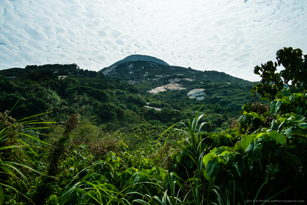
Looking up from sea level, there’s heavy foliage ahead, and not much of a trail at all.
The path initially winds past some hillside burial grounds and tombs.

At one point we need to literally squeeze between gaps in the rock.
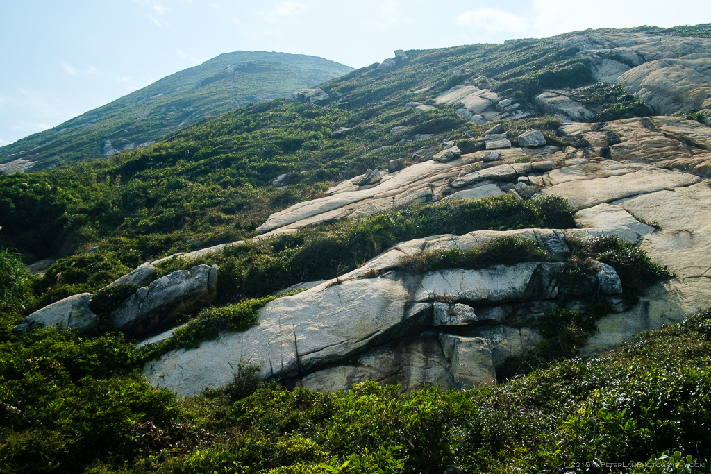
About a quarter of the way up, the daunting bare rock face.

Luckily the exposed granite affords a lot of grip, so despite the steep angle it’s a doable climb. Just don’t lose your nerve (or footing).

Past the bare rock, tall grass and shrubs, and big boulders.

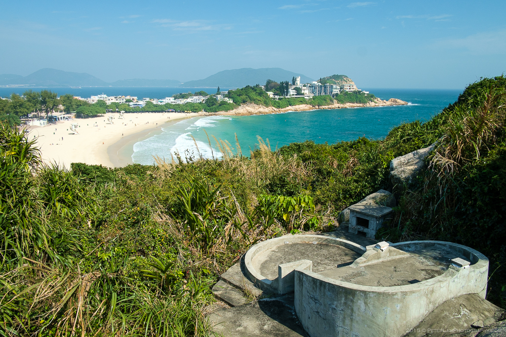
Looking back down at Shek O village and the beach.

Island Bay, Tai Tau Chau and Ng Fan Chau islands.

About half way up the peak, and the bushes are getting taller and more dense. Here you cannot see the trail, but follow the ribbons.
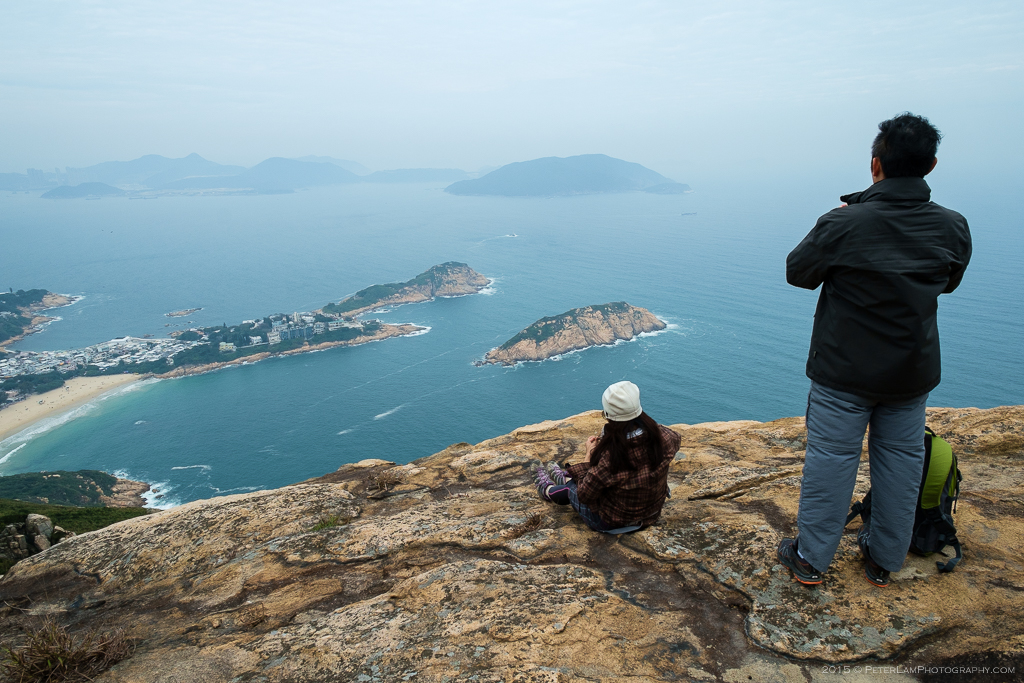
Taking a break before the final push to the peak.
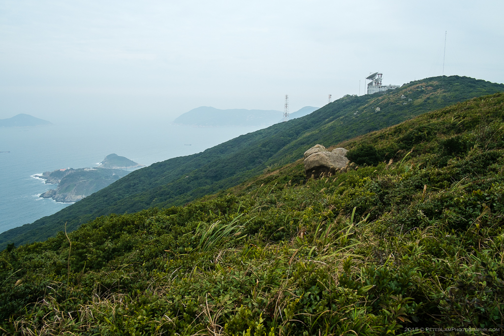
The peak is just ahead, near the radio transmission station. Down below you can see Cape D’Aguilar.

Finally reached D’Aguilar Peak at 325m. This is part of the Cape D’Aguilar radio station complex.

Descend from the radio station via the access road, and you will soon reach Cape D’Aguilar and the Marine Reserve.
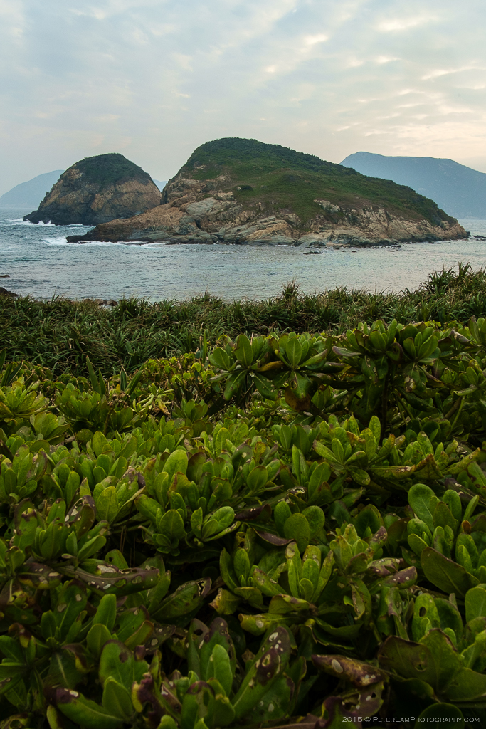
Kai Pei Chau island off the cape.

The rocky shore of Cape D’Aguilar.

Sunset over Hok Tsui Wan bay and Kau Pei Chau island.
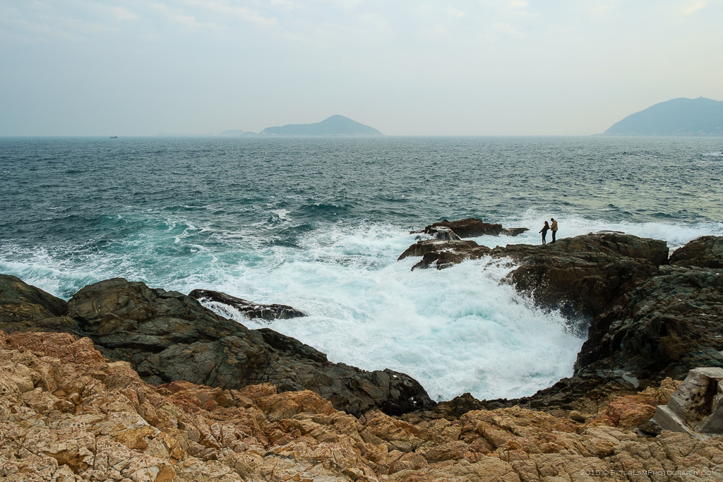
Big waves crashing in over the rugged coastline.
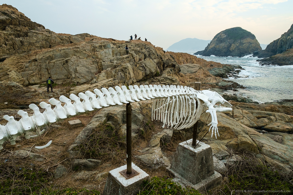
Whale skeleton exhibit at the Marine Reserve.
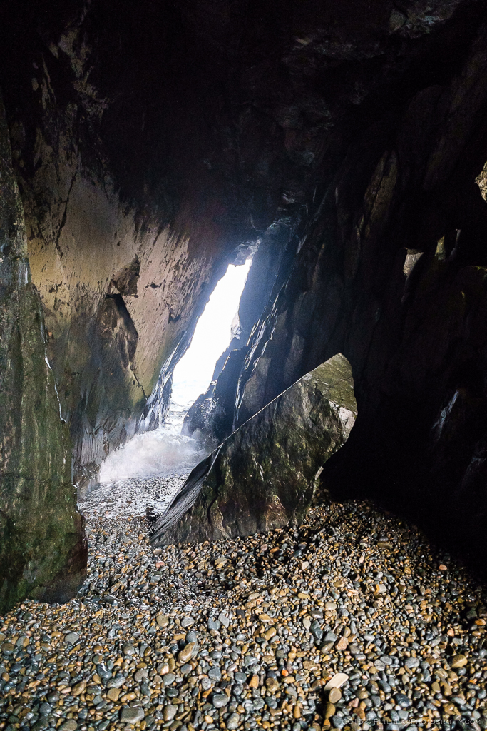
A narrow sea cave near the cape.

One of the many radio towers in the area.

Cape D’Aguilar Lighthouse (also known as Hok Tsui Beacon), the oldest lighthouse in Hong Kong.
——————————————

Wonderful memories of Cape D’Aguilar from the 1980s when access was limited and we were able to visit due to my father working for Cable and Wireless, who ran the radio station there. This was before the Marine Institute but it was definitely one of my favourite locations. At extreme low tides you could gain access to the island just off the beach and the rockpools were full of all manner of marine life. Many a great BBQ there and hours spent clambering over the rocks.
LikeLike
Sounds like very good times! Hopefully with the area declared a marine park, its natural beauty and wildlife will be protected for future generations to come.
LikeLike
How did you get back to civilisation from the end of the hike?!
LikeLike
There is a road that leads to the Marine Institute at the end of the peninsula. We just followed that back to the starting point.
LikeLike
Stunning! Looks like one for seasoned hikers.
LikeLike