Mount Assiniboine Provincial Park is rightly considered one of the most fantastic and picturesque hiking areas in Alberta and British Columbia. Together with the the Berg Lake Trail at Mount Robson, this popular trek offers an unforgettable experience deep in the heart of the Canadian Rockies and is all the more special because there are no roads into the park – the only way in is by foot, horse, or helicopter. Naturally, my friends and I choose the most rewarding (and budget friendly) option: a six-day, 60-km backpacking hike to the “Matterhorn of the Rockies” over the Civic Holiday week in early August.
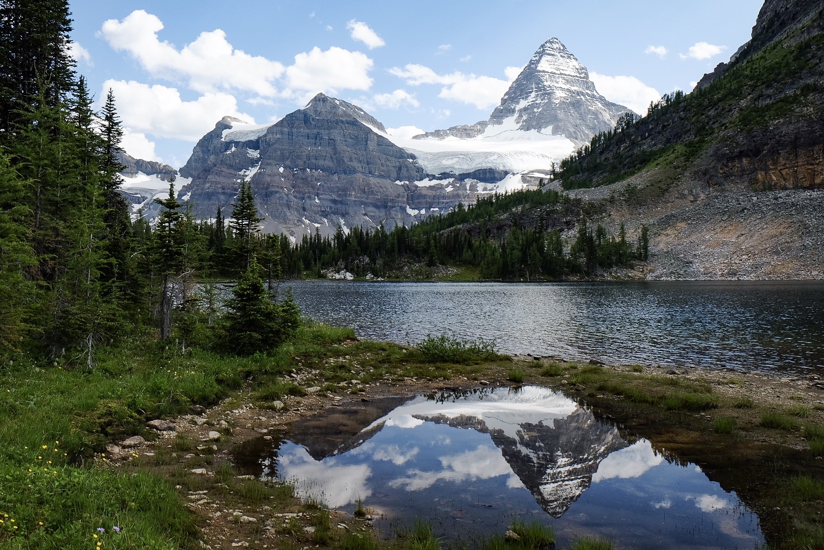
Mount Assiniboine seen from Sunburst Lake.
Characterized by raw natural beauty and the pyramidal peak of its signature mountain, Mount Assiniboine Provincial Park is part of the Canadian Rocky Mountain Parks UNESCO World Heritage Site. Noted for its ecological and geological significance, this rugged landscape is home to rare animal and plant species, pristine lakes and glaciers, lush valleys and snow-capped peaks. It should be on the must-do list of any serious backpacker and avid hiker.
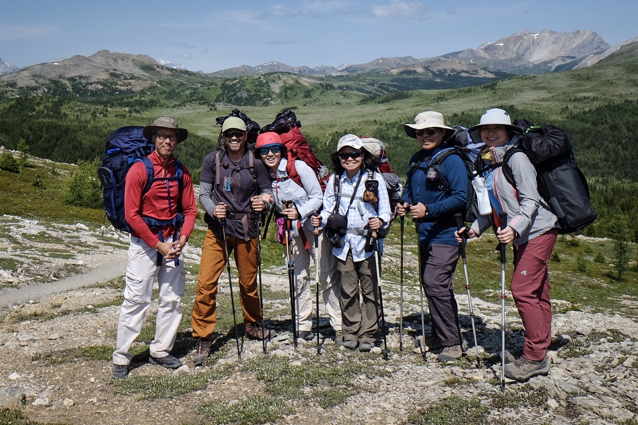
The trekkers: Jeff, myself, Yvonne, Emily, Ken, and Lily.
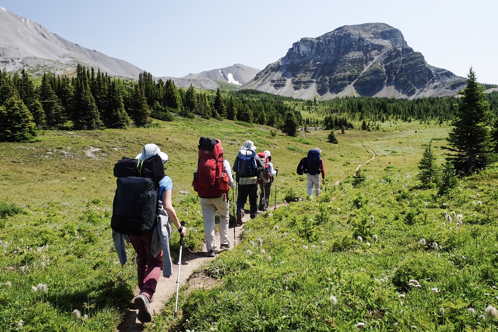
There are a myriad of trails criss-crossing the park, but we chose the most direct that covers plenty of ground and varying landscapes: starting at Sunshine Village Ski Resort adjacent to British Columbia and finishing at Mount Shark in Alberta (and flipping between the provinces several times along the way). Along the route are a few easy sections as well as some significant elevation changes that proved quite challenging, particularly when carrying a heavy pack, and some involved minor rock scrambling. It’s a good mix and all part of a great backcountry adventure.

The route taken from Sunshine Village to Mount Shark.

Elevation changes along the route (from https://www.explor8ion.com).
We started planning this trip some 8 months ago, primarily due to the complicated accommodation logistics. Along the way we stayed at three nights at different campgrounds and two nights in rustic cabins, all managed by different entities (BC Provincial Parks, Assiniboine Lodge, and Banff National Park). For the peak hiking season, places fill out almost immediately after reservations commence, and it doesn’t help that all three have different rules and opening dates. But the efforts are well worth it, and there are plenty of good sources online to help guide you through the process (this one from The Outbound Collective is especially useful). You will also need to arrange transportation to and from the trailheads, as this is a point-to-point hike.
Our 6-day itinerary is highlighted below – over the next few weeks I will be following up with more detailed posts and photos for each day, so check back often for updates. The headings will be linked to the posts.
Day 1: Sunshine Meadows to Porcupine
Crossing Sunshine Meadows to Citadel Pass.
Our adventure starts at the Upper Alpine Village at the Sunshine Ski Resort on the Alberta/BC boundary. We hike through Sunshine Meadows, passing Howard Douglas Lake and the Citadel Pass, on our way to Porcupine Camp, for our first night on the trail. Total distance is about 13 kilometers with a massive 500m descent from Citadel Peak.
Day 2: Porcupine to Og Lake

Leaving Valley of the Rocks to Og Lake.
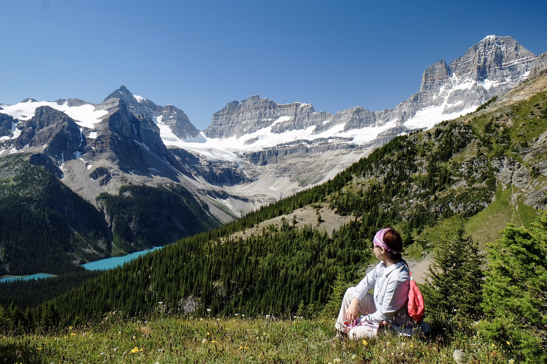
From Porcupine Camp, we make our way to Og Lake through the challenging terrain of Golden Valley and Valley of the Rocks. Approaching our next campsite, we get our first real glimpse of Mount Assiniboine, and it’s spectacular. The scenery and serene waters of Og Lake make this the best tent site on the entire hike.
Day 3: Og Lake to Mount Assiniboine

Assiniboine Lodge and Naiset Huts at Lake Magog.
Day 3 is a short and sweet 6-km hike to the mid-point of our trek – the Assiniboine Lodge and Lake Magog located at the base of Mount Assiniboine. Here we will spend two nights in one of five Naiset Huts, rustic log cabins built by the Alpine Society of Canada that serve as basic overnight shelters for park visitors.
Day 4: Nub Peak

Heading up the Nublet and Nub Peak for stunning views.
Time to drop our heavy backpacks in exchange for day pack and head up the most iconic hike in the Assiniboine area: the Nublet and Nub Peak offer some of the most spectacular views in the entire park. Lucky for us, the weather is absolutely perfect (as it was for the entirety of our trip). This 12-km loop with some light scrambling is easily done as a day hike. For many trekkers, this is the highlight of their visit.
Day 5: Magog to Marvel via Wonder Pass
The beauty of Wonder Pass.
After two nights under a solid roof, it’s back on the trail and on to the second half of our big hike. This 13-km section includes a hard descent to Marvel Lake, but not before a side scramble up to a stunning viewpoint at Wonder Pass. This was one of the hottest days on the trail, and everyone is pretty exhausted by the time we reach our last campsite of the trip at Bryant Creek.
Day 6: Marvel Lake to Mount Shark
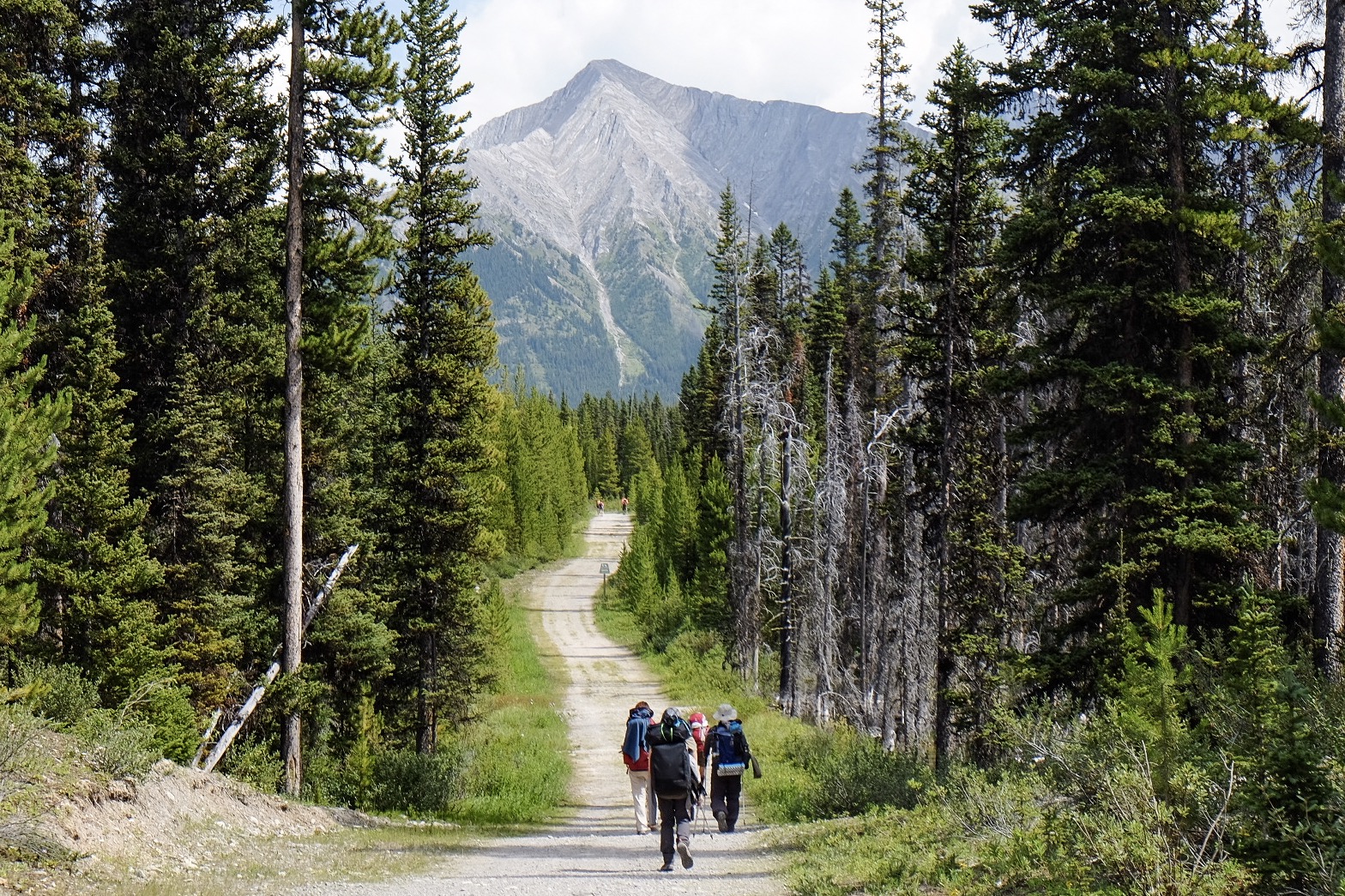
On the long path to the Mount Shark trailhead and the end of our hike.
The last day, though long, is one of the easiest due to the relatively flat trail out to the Mount Shark trailhead. We take our time and enjoy the shaded forests and cool streams, a contrast from the more rugged scenery of the previous five days. Finally reaching our pre-arranged ride at the Mount Shark parking lot we’re elated at the prospect of showers and real food. A perfect end to another great adventure in the Canadian Rockies.

Awesome photos and thanks for the detailed route guidance.
Were there any cold nights or campsites on your trip? Or did it stay pretty moderate?
Also curious what taxi or shuttle service you used for your group?
I’ll be going in mid-August next month. Thanks!
LikeLike
How did you reserve the Porcupine campground? I cannot see it on either of the Federal or BD reservation sites? thanks
LikeLike
Hey there, this trip looks epic! I am planning this exact same trip for next week (with one less day at Magog Lake) but I was wondering how long each day took to hike as well as how do you show your National Parks pass on your car as well as on your person for the parking lots etc? Do you need to show your pass on the car?
LikeLike
Rachel, they way we planned it, there wasn’t too much hiking each day. Say 5-6 hours tops, and we were going at a pretty leisurely place. Typical when you have 2 photographers who stop at every turn 🤗. I think we brought along a printout of our campsite bookings. For the car we didn’t park at the lots as we had arranged transportation to and from the trailheads, but I guess it doesn’t help to put a copy on the dash!? Maybe check with the park to be sure.
Have a great trip and be safe! Such a beautiful part of Canada. Really quite envious of you right now!
LikeLike