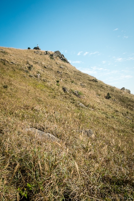
This weekends trek takes us from once again from Lantau Island’s northern shore to the southeastern bays, but this time via a mountain ridge that skirts two of the islands highest peaks – Lin Fa Shan (literally Lotus Mountain 蓮花山 ) and Yi Tung Shan.
The hike promises spectacular views of Tung Chung and the airport on the north, and Silvemine Bay towards the east. The weather was fine with lots of sunshine and a bit of haze, and a light breeze. If you attempt this hike (as for any hike in Hong Kong), bring lots of water and a hat as there is very little shade and no refreshment stands on this route. The highlight is reaching the peak of Lin Fa Shan at an altitude of 766m above sea level.
The path, in contrast to the paved cement trail to Mui Wo earlier in the week, is entirely stone steps, gravel, and overgrown grass. The trail, starting with a strenuous climb from Pak Mong village to the north, winds its way south through rolling grassy hills in a gradual ascent to the the Lotus Mountain, eventually connecting to Section Two of the Lantau Trail at the base of Yi Tung Shan. Total distance is around 6km with an elevation climb of over 650m, and another 3km down Section Two. The climb to the actual peak is a side trip from the main trail and an additional 100m higher, but well worth the effort. At the top of the mountain, you’re pretty much making your own trail through six-foot grass… A machete would come in handy here! The reward is a great view in all directions.
This hike was very different from the other ones I’ve tried here so far, mainly due the lack of dense forests that is typical of Hong Kong mountains. Here there were rolling, windswept grass meadows dotted with shrubs and huge boulders of all shapes and sizes. It felt like I was somewhere in Europe. No villages or signs of civilization, and there were only a few fellow hikers on the trail this weekend. An immensely satisfying hike, especially when you reach the top! This is the highest I’ve trekked in Hong Kong so far.
Once connected to the Lantau Trail, it’s a gradual descent towards Mui Wo with great views of Silvermine Bay in the distance. Or, if feeling particularly energetic, you could continue west towards Sunset Peak for a spectacular sunset vista. Maybe next time… I was beat after 6 hours, and so grabbed the bus at the bottom of the trail back to Tung Chung.
Click on the photos for larger versions. All were taken with the 14mm f2.8 wideangle lens and finished in LR5.


Thanks for wrriting this
LikeLike
beautiful pictures, pete! nice to see pics of hk that doesn’t have mobs and mobs of people.
LikeLike
Thanks Em! Hong Kong is surprisingly people-free in many places.
LikeLike