The Boyne Valley Provincial Park is located about an hour’s drive from Toronto, some 20km north of Orangeville. It encloses the Boyne River which cuts through the southern heartland of Ontario, and contains a mix of gentle hills, clear meadows, dense hardwood and pine forests, and swampland. These are the results of glacial moraines left from the ice age. A number of well marked and maintained hiking trails are readily accessible for exploration, including a section of the much longer Bruce Trail.

The hike comprised of two loops.
Last weekend, some friends and I tackled this 13km hike that comprised of several trails strung together and eventually looping back to the starting point. Although it was sunny on some sections of open field, most of the hike was in the shade of the woods. The mosquitoes were out in full force, too – so bug repellent is definitely recommended! And, of course, lots of water and a snack for the 5-hour trek.
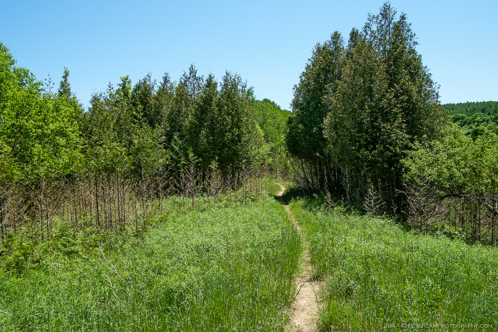
Primrose Loop Side Trail
Starting with the Primrose Loop, this trail to the west of County Road 19 passes through much of Boyne River Valley. It passes through dense cedar and pine woods as well as open fields, logged by pioneers a long time ago and now left as meadows. Some areas have also been replanted as forests. The small loop connects with the larger Bruce/Boyne Valley trails with an access path through some beautiful rolling hills.


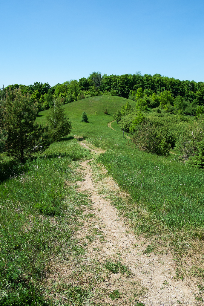
 Murphy’s Pinnacle Side Trail


Just as you reach the main Bruce Trail, a side trail leads to Murphy’s Pinnacle, the highest point in the area. After a climb up the small hill, there’s a great view of the surrounding countryside in all directions.


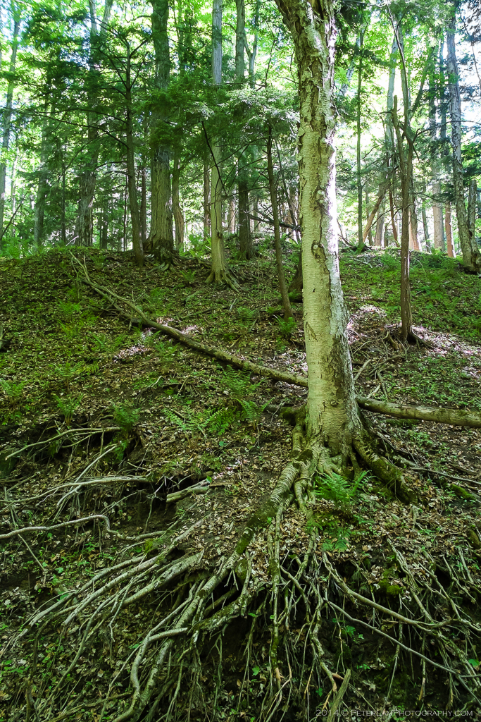
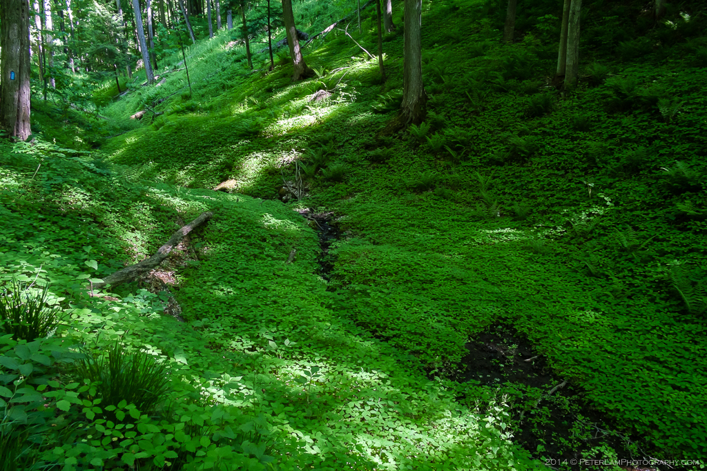
 Bruce Trail


Part of the main loop is a section of the Bruce Trail which runs from the Niagara Peninsula in the south to Tobermory on Georgian Bay in the north. At the top of the loop, we pass a few more meadows and open areas before entering a heavily wooded section in a deep ravine following a small stream. Here the forest floor is covered with lush growth – a very pretty area, but unfortunately lots of mosquitoes too. The path then joins the Boyne Valley side trail, after a short walk following a paved road.


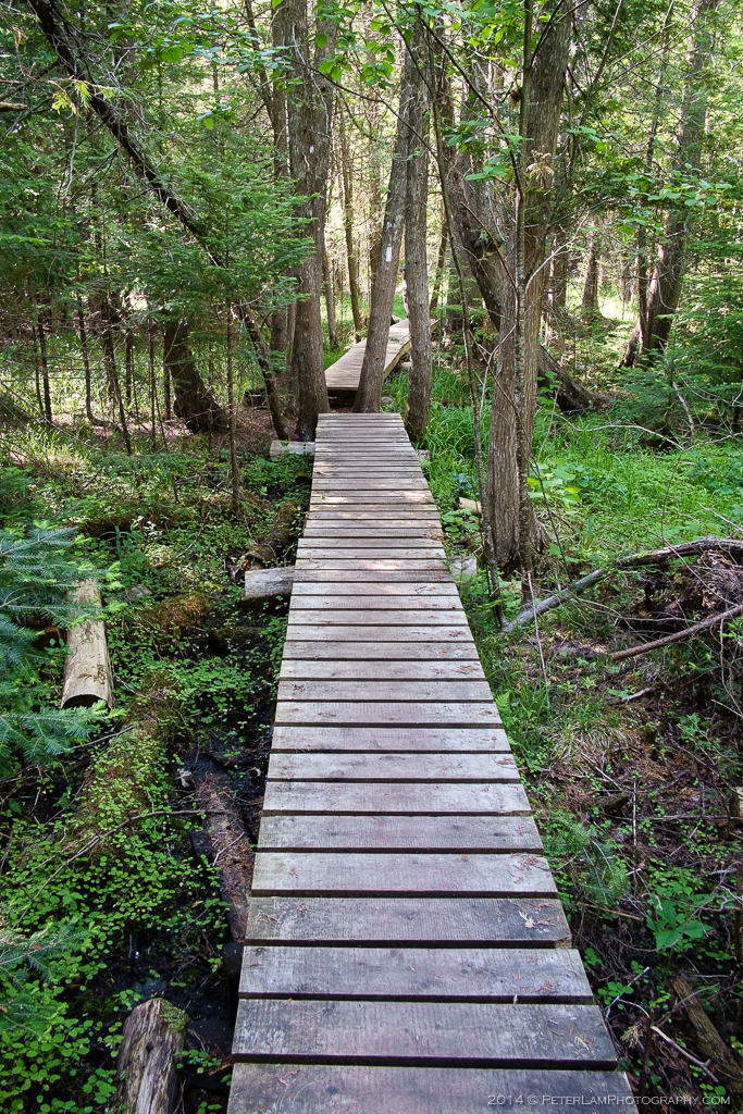
 Boyne Valley Side Trail


This trail forms the second half of the large loop, and is probably the toughest part of the as it is a constant uphill climb. The Boyne Valley Trail then rejoins a section of the Bruce Trail, where there are a number of boardwalks and bridges built over the swampland and many streams. We make our way back to the start of the loop at Murphy’s Pinnacle, and from there we backtrack across the meadows to the starting point of the hike.