Hong Kong’s highest peak is Tai Mo Shan (大帽山) which literally translates to “Big Hat Mountain” – perhaps because its 957m tip is often shrouded in cloud and mist. On a good day, however, you are rewarded with great views of the city in all directions. It is located in the smack middle of the New Territories and the centerpiece of the Tai Mo Shan Country Park. Technically the last few meters to the top are off-limits to the general public, as the summit is occupied by a Hong Kong Observatory weather radar station.
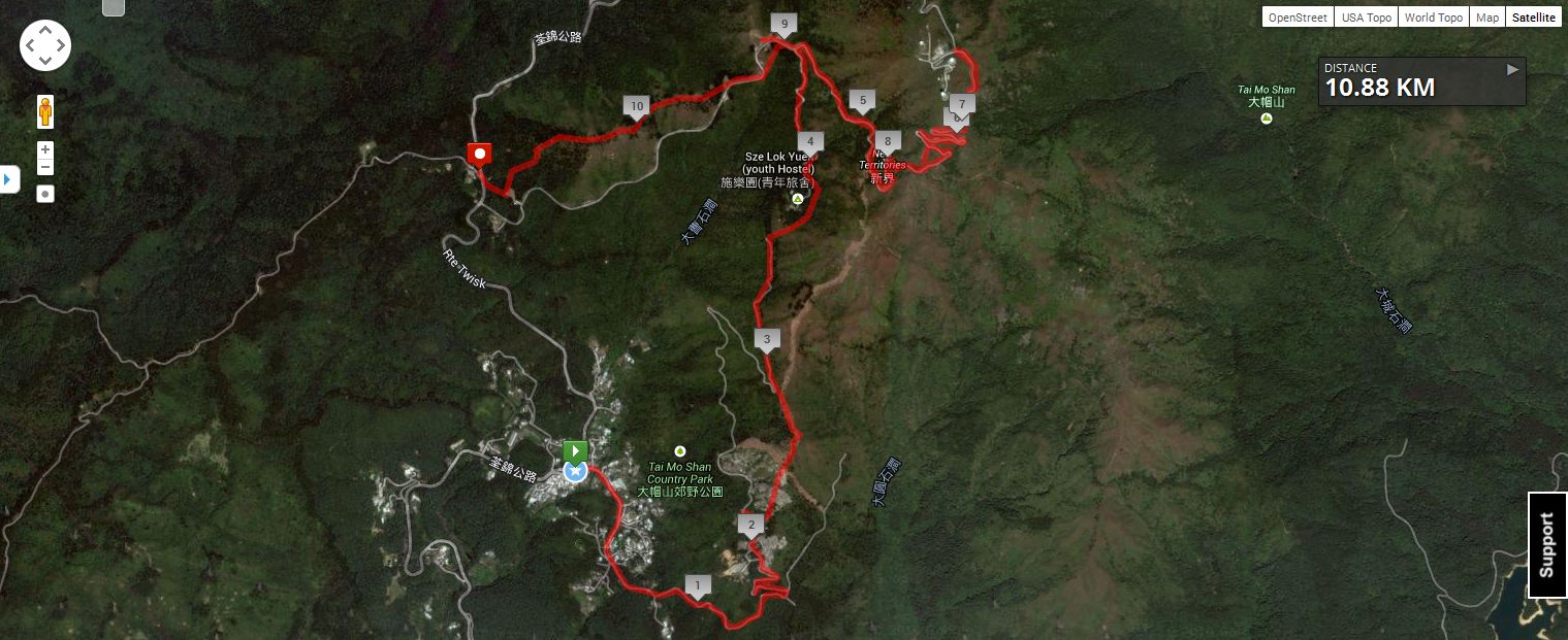
The unusual route taken to the top of Tai Mo Shan.
There are several ways to reach the summit, the most common being to just follow the MacLehose Section 8 trail. However we choose a rather unusual route by starting at Chuen Lung village (mainly because of the availability of a pre-hike breakfast) and then taking a local route through old Heung Shek Cemetery and approaching the mountain from the south. The last section of the trail is a winding paved road to the weather station at the top. Once at the summit, we enjoy the milder temperatures and panoramic views before descending and finishing at Tsuen Kam Au via a portion the MacLehose trail.
Despite being the city’s highest point, Tai Mo Shan is not the steepest or most challenging of hikes, but there is still some satisfaction in taking this peak off the “to-do” list of Hong Kong mountains. The tougher Ng Tung Chai trail and its beautiful waterfalls (which we hiked last year) are part of the northern side of Tai Mo Shan.

Chuen Lung village, the starting point. Very popular on the weekends.

Hiking fuel: A hearty dim sum breakfast.

This is an old-school dim sum restaurant. Everything is self-serve. Table manners and food hygiene optional.
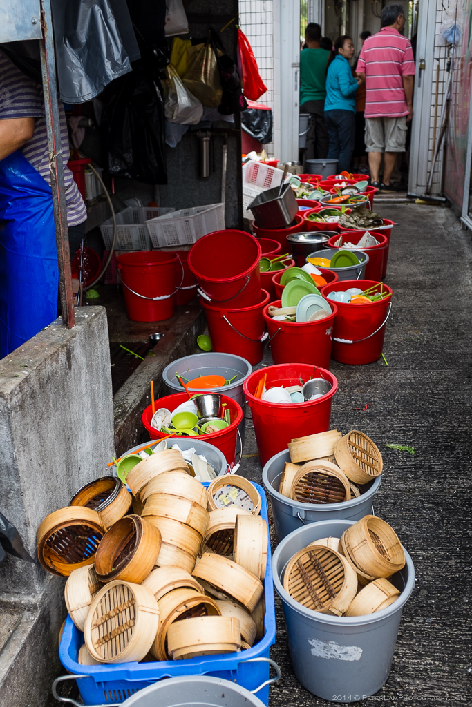
The dishwasher station. This is why you wash everything again in boiling water before you eat!

Villagers selling produce to visitors.

Onwards! Here approaching Heung Shek cemetery on the mountain.

In Hong Kong even the cemeteries are densely packed.

This is a popular cemetery. Graves and tombs cover most of the mountainside.

Looking back you can just make out Tsuen Wan and Tsing Ma bridge in the distance.
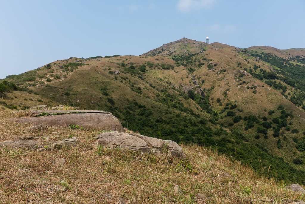
Further along the trail and up the hills, the observatory at Tai Mo Shan peak is visible.

Nearly at the top. This last section is restricted to authorized vehicles only.

Almost there… one of the observatory towers.

Looking down the winding path which is quite popular with cyclists also.

The weather radar station at the peak.

At the top! This is as far as the public can go – restricted access beyond.
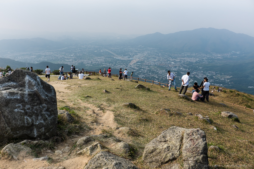
The lookout and picnic area at Tai Mo Shan Road. On a good day you can see all the way north to the Mainland.
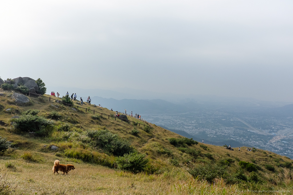
A rest before continuing east on MacLehose Trail Section 8.

What amazing views! I’ll have to check this out when I can.
LikeLike