
The Tung O Ancient Trail is a footpath on the northern shore of Lantau Island that connects Tung Chung with the Tai O fishing village. Also known as the Tung Tai trail, this was the main route between the two villages before the urbanization of Tung Chung New Town. Today, most of the trail is a paved cement footpath that is used mostly by locals who still live in the small villages along the way. Only the last section is an actual mountain trail, so this 13km trail is more a leisurely walk than a hike.

The route along Lantau’s north shore.
Starting at Tung Chung, you’ll immediately begin to notice the changes that rapid urbanization has brought to the island. We pass through the mangroves at Tung Chung Bay, where the local fish population has dwindled. Along the way there are abandoned buildings where presumably the villagers have left for the city. Across the narrow channel to the north, there is the constant roar of airplanes taking off from the busy airport. There is also heavy construction and pollution on the water due to the Hong Kong-Macau-Zhuhai mega bridge project.
Despite the encroaching modernization, quiet traditional life still continues in the remaining village hamlets. The stores at Sham Wat Wan Bay cater now to hikers on the trail, providing refreshments and light meals. And in Tai O, the traditional stilt houses built on the water are a major tourist attraction.
Click on the photos for a better view. These were processed in Lightroom with the Old Polar colour filter.
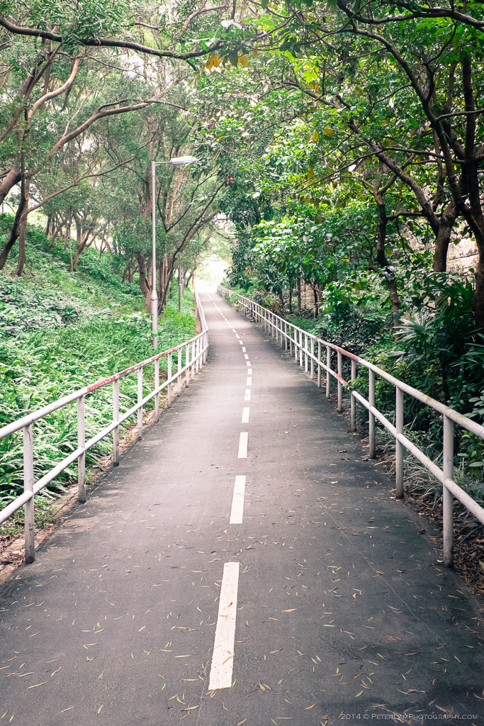
We start the walk on the bike trail at Tung Chung New Town.

Hanging laundry at Yat Tung Estate. Many residents here were moved from Chek Lap Kok village when the airport was built.

Old traditions die hard. Dried citrus peels are a lucrative business.

Meagre fishing at Tung Chung Bay.

Fiddler crabs in the mangrove.
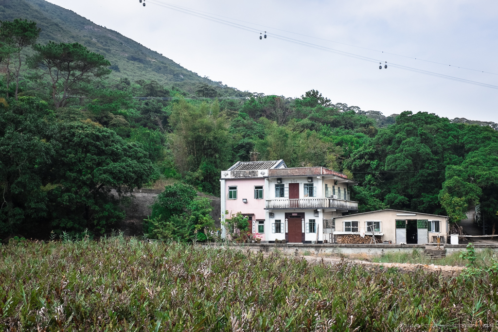
Village housing beneath the Ngong Ping 360 cable car.

Abandoned buildings near Ngau Au. Yat Tung Estate in the background.

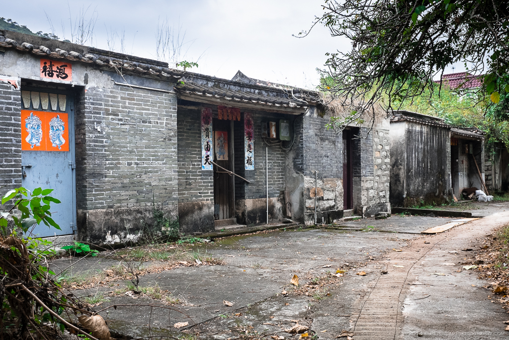
Shan Tau Village. More dogs than villagers.

The village school, also abandoned.
Remnants of a different time…

Low tide and oysters at Hau Hok Wan.

Buddha and fish graffiti?

At Sha Lo Wan Tsuen village.

Old tin roofing and rusty shacks.

San Shek Wan village, about half way through the hike.

Typical of the makeshift homes built in the area.

Fishing on the pier at Sham Wat Wan bay. Here you can stop for refreshments before the last section of the hike.

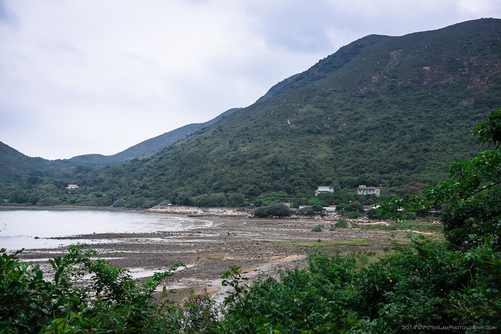
Looking south from Sham Wat.

Bananas for sale – honour system! The road, one of the few in the area, heads to Ngong Ping village.
Looking back, Sham Wat Wan bay at low tide.
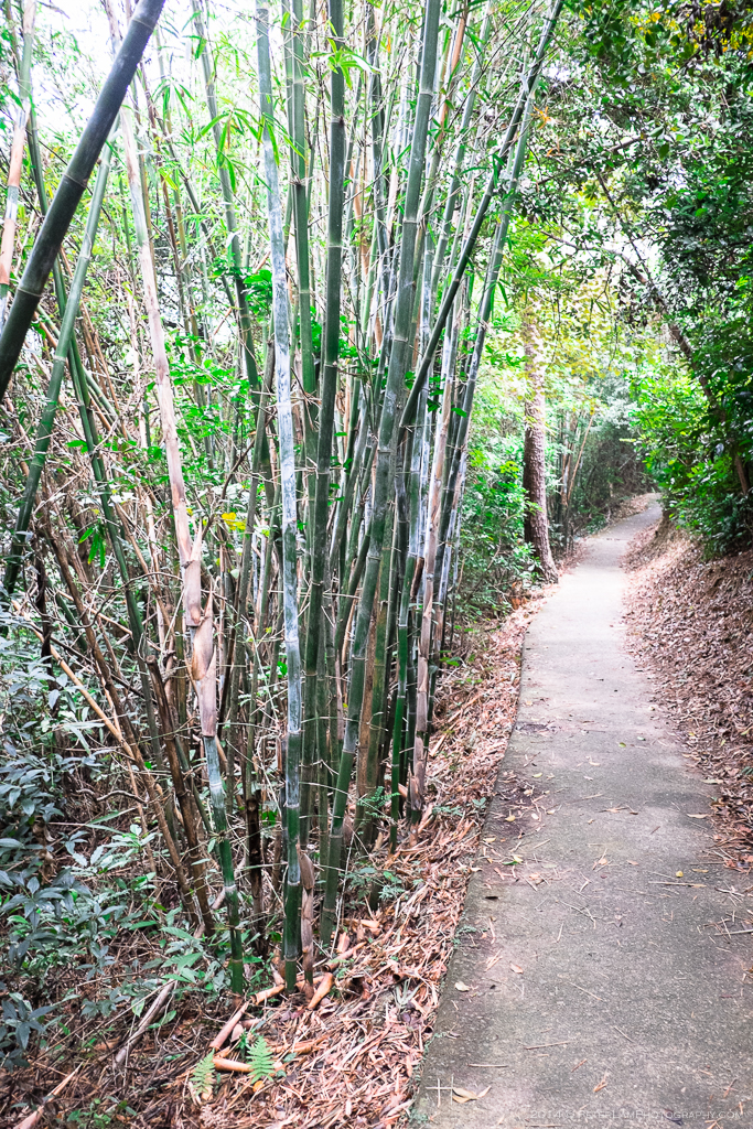
Small bamboo grove at Tit Tak Shue. Here the concrete soon turns to a mountain trail.
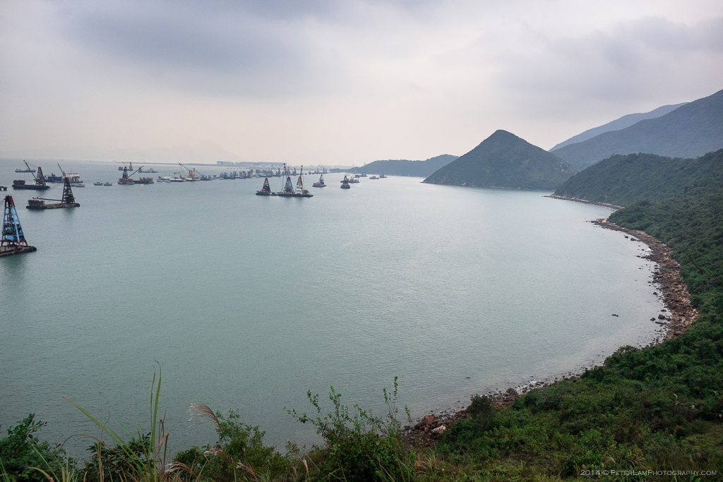
On the water the construction of the massive Hong Kong-Macau-Zhuhai bridge has begun.
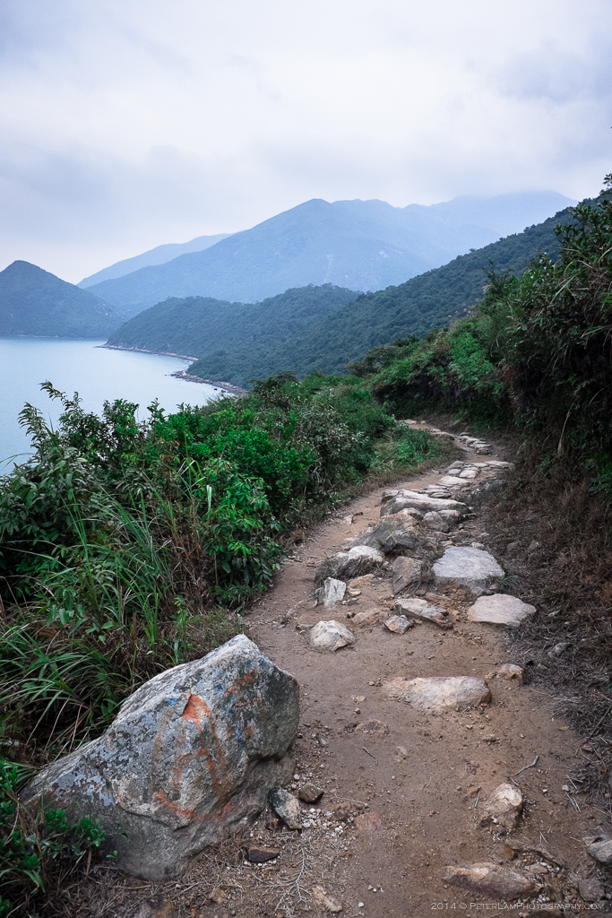
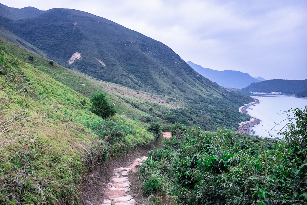
The last few kilometres of the hike is a beautiful mountain trail.
Approaching Po Chue Tam and our final destination, Tai O, in the distance.

The Yeung Hau Temple at Po Chue Tam. It is the biggest and most important temple in Tai O, built in 1698.

The village of Tai O nestled in the valley.
The “Venice of Hong Kong” with traditional stilt houses.
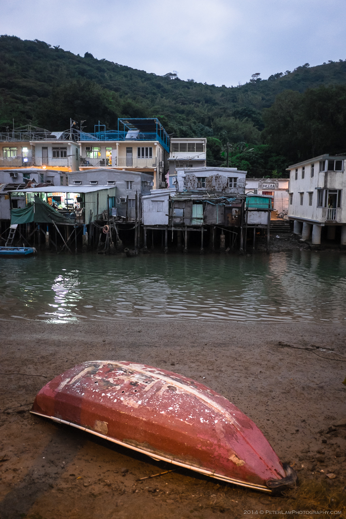
This area is less frequented by tourists. You can still catch a glimpse of old village life.

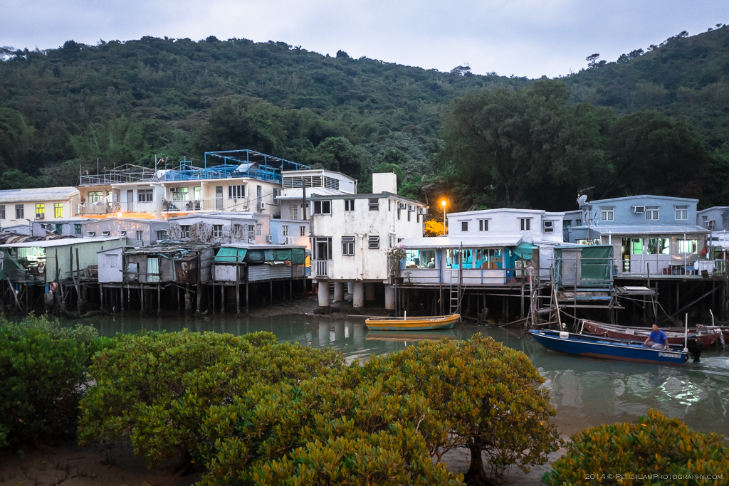
Evening at the fishing village. Dinner time.

As night falls the tourists go home and the village returns to its quiet slumber.

Pingback: Villagers spark confrontation after locking gate on Tai O trail – Lantau News·