
Among Hong Kong’s many hiking trails, unique is the one leading up to the territory’s tallest peak, Tai Mo Shan (大帽山). Nestled in the thick foliage of forested slopes, the winding and rugged Ng Tung Chai (梧桐寨) route leads through a series of beautiful waterfalls that is completely different from anything else you’ll ever see in the city. During the height of summer it is a very popular route, and a great way to cool off in the heat.
This trek was actually the first hike I did in Hong Kong when I arrived here many years ago. I remember it being pretty tough back then, and I was quite sore for a few days after (and that was not even reaching the top of the mountain). Well I’m happy to report that it was much easier this time around – I guess years of practice does make a difference!
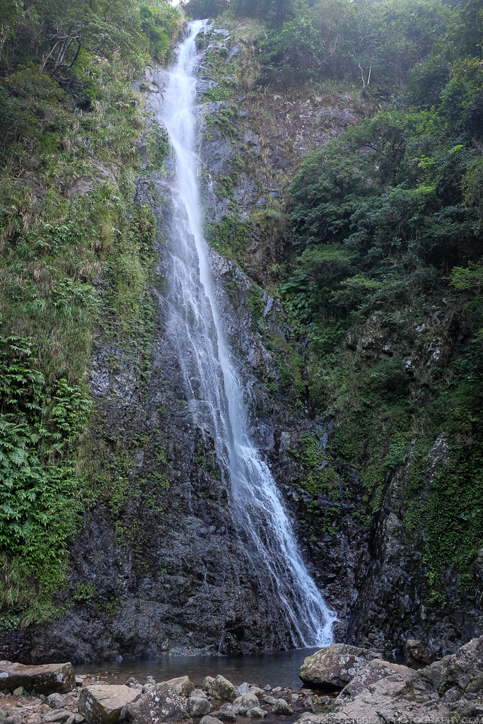
The Lower Falls at Ng Tung Chai.
The official trailhead starts near Ng Tung Chai village on the northern slope of Tai Mo Shan, easily reachable by taxi or minibus from Tai Wo station. The first portion of the trail is a paved road that leads past the old Hakka village and Man Tak Yuen (萬德苑), a colourful and ornate Taoist temple. Follow the clear signage towards the waterfalls, and the path soon turns to a narrow dirt trail through thick forest as it enters Tai Mo Shan Country Park. The climb begins in earnest.
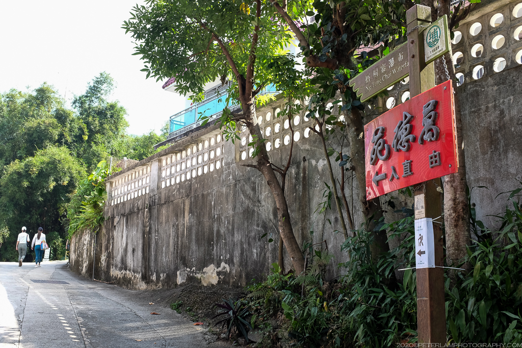
Trailhead at the Ng Tung Chai village.
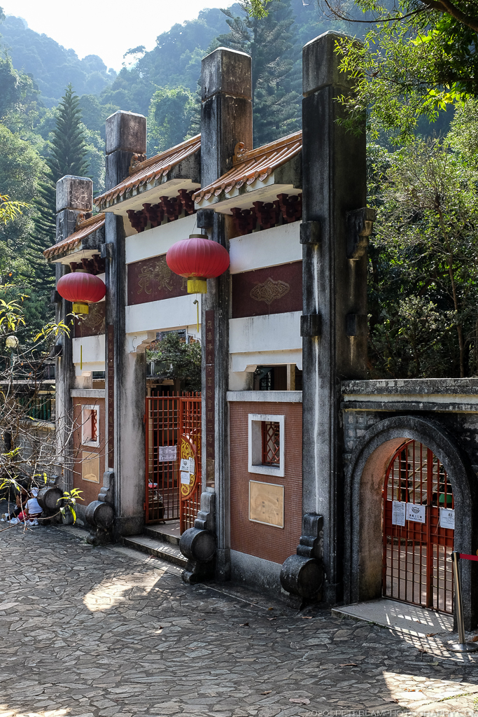
Entrance to the Man Tak Yuen temple.
A stream at the beginning of the mountain trail.
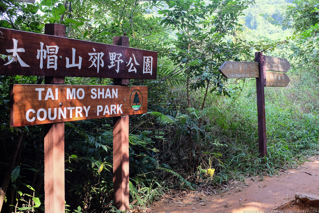
Officially entering Tai Mo Shan Country Park.

Stone steps and dirt trail through the dense forest.
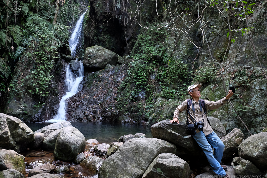
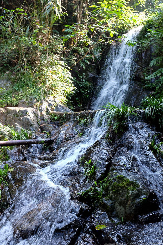
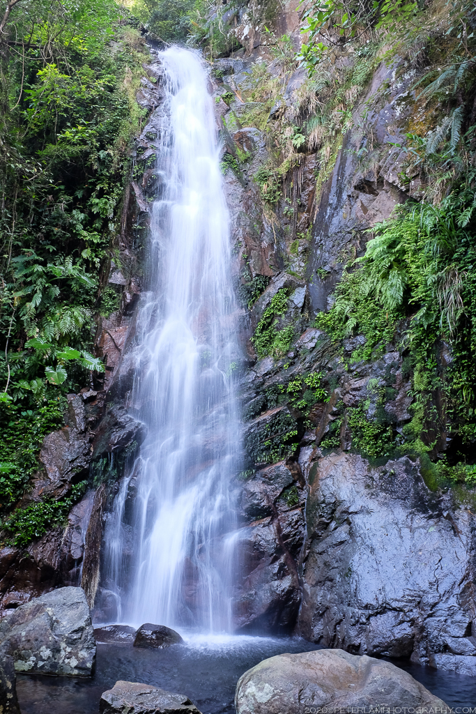
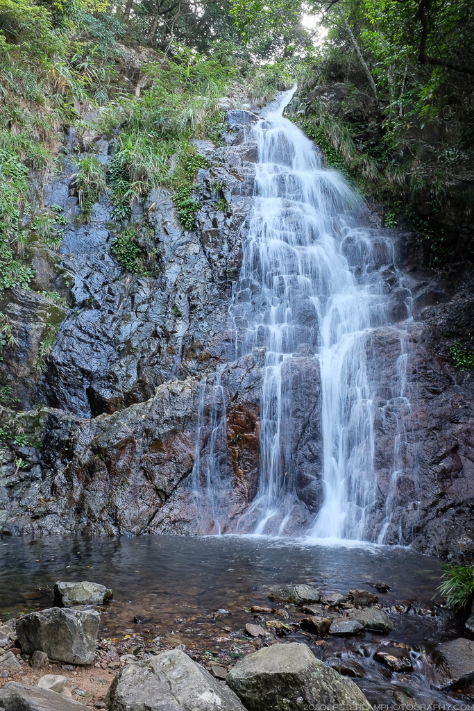
The Ng Tung Chai falls are a series of four waterfalls along the climb. The first, the Lower Falls, is nestled deep among tall rocks and towering trees that gives it a tropical jungle kind of feel. The Middle Falls are more dramatic and possibly the prettiest of the four. Climb a bit higher and you’ll reach the Main Falls, which at 35 meters is Hong Kong’s tallest waterfall. The top of the cascade is fed by the Scatter Falls, the final of Ng Tung Chai’s waterfalls.
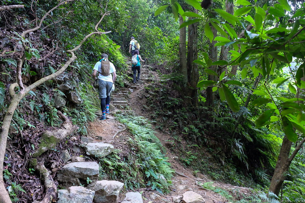
Some sections of the route are quite steep with huge boulders and can be quite challenging for first-time hikers (especially when the rocks are slippery) so proper footwear and plenty of drinking water is always recommended. Due to its popularity, it can also be crowded on weekends, so be ready to share the narrow trail with fellow hikers.
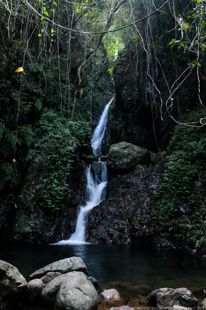
The Lower Falls.
The Middle Falls.
Climbing ever higher on seemingly endless steps.
The Main Falls of Ng Tung Chai, Hong Kong’s tallest waterfall.
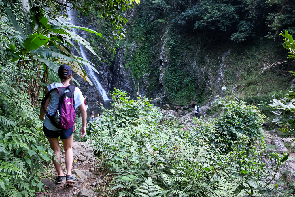
Fellow hikers on the trail, though not too busy today.
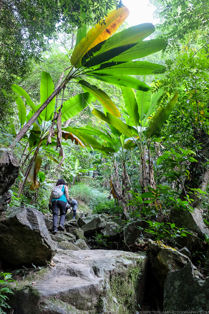
Huge boulders and banana trees – it’s a jungle!
At the top, the Scatter Falls.
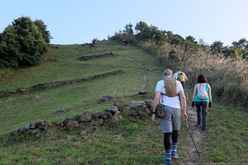
After reaching the Scatter Falls, most people opt to follow the official route and loop back down to the starting point at Ng Tung Chai (which is what we did that first time on the trail). This time around we have a bit more energy, and so decided to push on to the top of Tai Mo Shan by following an unofficial trail leading up and out of the forest, and further towards the peak.
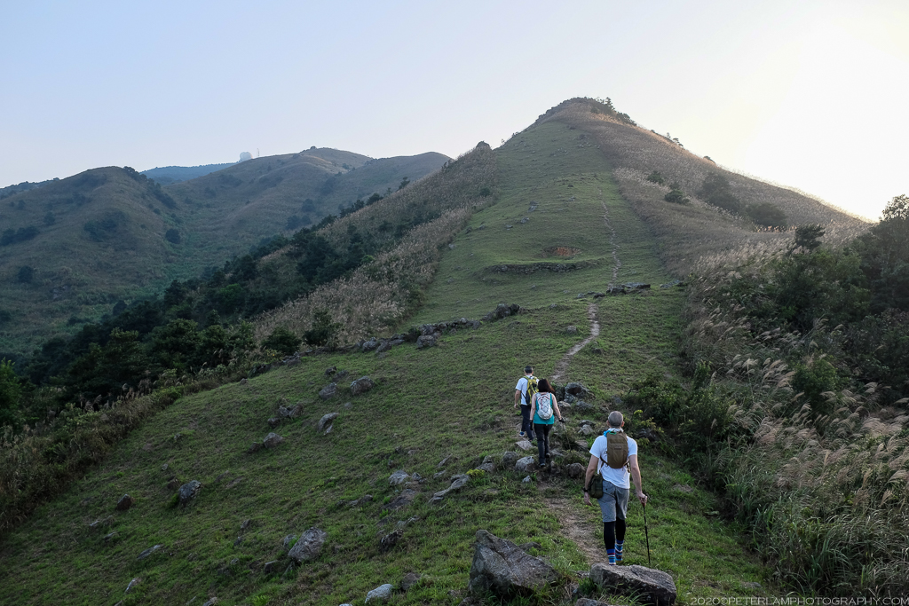
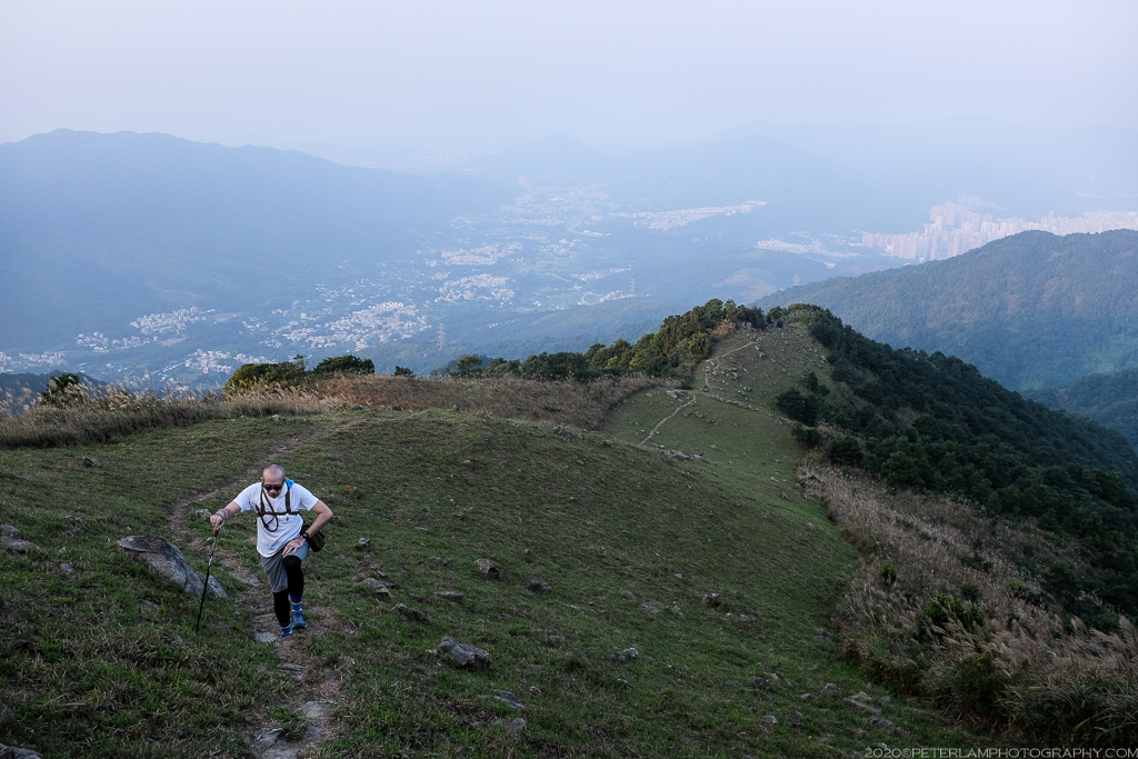
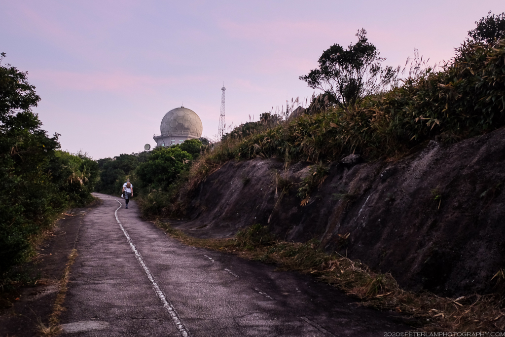
Climbing above the tree line, this section of the hike is completely different from the waterfalls portion. The thick jungle growth is replaced by rolling hills and open grassland with great views of the valleys below. Soon the weather station at Tai Mo Shan is visible in the distance. As we head towards the installation, the final hike to the top is a paved service road that’s a pretty boring walk, except for the occasional view of the setting sun.
After clearing the forest, we climb higher towards Tai Mo Shan.

Silver grass typical of Hong Kong in the fall.
Following the trail and pushing higher.
Looking back north at Tai Po town far below.
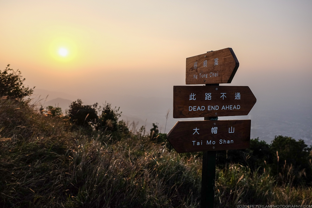
Can’t go wrong if you follow the signs…
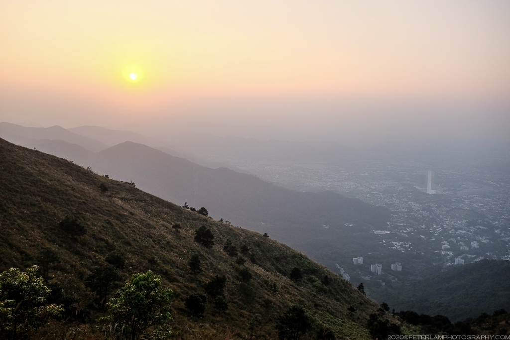
Looking west towards the sunset over Kam Tin.
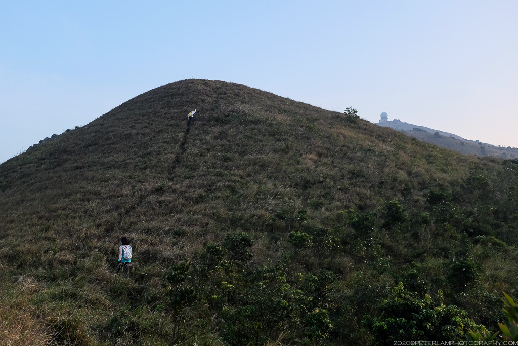
One more hill to tackle, so close!

Finally reaching the (boring) service road that leads to the weather station at the summit.
At 957m above sea level, Tai Mo Shan is Hong Kong’s tallest peak, though the actual summit is off-limits to the public as it is occupied by Hong Kong Observatory’s weather radar station. Still, there are expansive views of the city, and looking south one can see the sprawling Tsuen Wan and Tsing Yi towns below. The remainder of the hike down follows the a service road about 6 km all the way to Tai Mo Shan Country Park Visitor Center, and a bit further to catch a bus back to civilization. This downhill stretch, while not difficult, is long and uneventful – so enjoy the views from the top while you can!
It’s dusk by the time we reach the top.
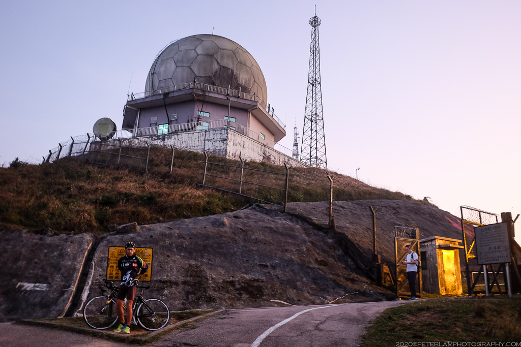
One of several weather radars at the top of Tai Mo Shan.
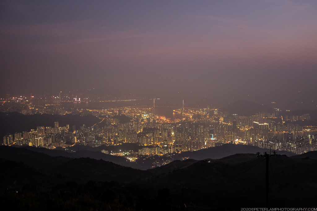
Darkness as we descend the southern slope Tai Mo Shan towards Tsuen Wan.

Hi Peter,
I am planning to do a youtube series on food, life, travelling and outdoor activities. In one session, we will talk about Lam Tsuen River and where it originates. May I ask for your permission to use some of your photos of the waterfalls of Tai Mo Shan. Our youtube series is not for commercial purposes, it`s to introduce to the public nice things like food and places to visit in Hong Kong. If your permission is granted, kindly inform me as to how to acknowledge your work in the video. We will of course let you have a link to the video if made. Thanking you in advance!
David
LikeLike
Hi David, yes sure, you can go ahead and use the photos from the blog. You can credit by mentioning or linking to the website. Looking forward to your video!
LikeLike
Pingback: 20 Places to Visit in Hong Kong - Magazine Bee·