At a height of 702 meters, Ma On Shan (馬鞍山, literally Horse Saddle Mountain) stands among the ten highest peaks in Hong Kong. Bordering Sha Tin and Tai Po districts, its distinctive shape is easily recognizable from the surrounding townships; together with its adjacent summit, The Hunchbacks (牛押山, also known as Ngau Ngak Shan) at 677 meters, the two peaks are connected by a narrow ridge that forms the shape of a horse’s saddle. This is a fairly strenuous hike over a distance of 9 kilometers with plenty of climbing, but the stunning views make it well worth the effort.

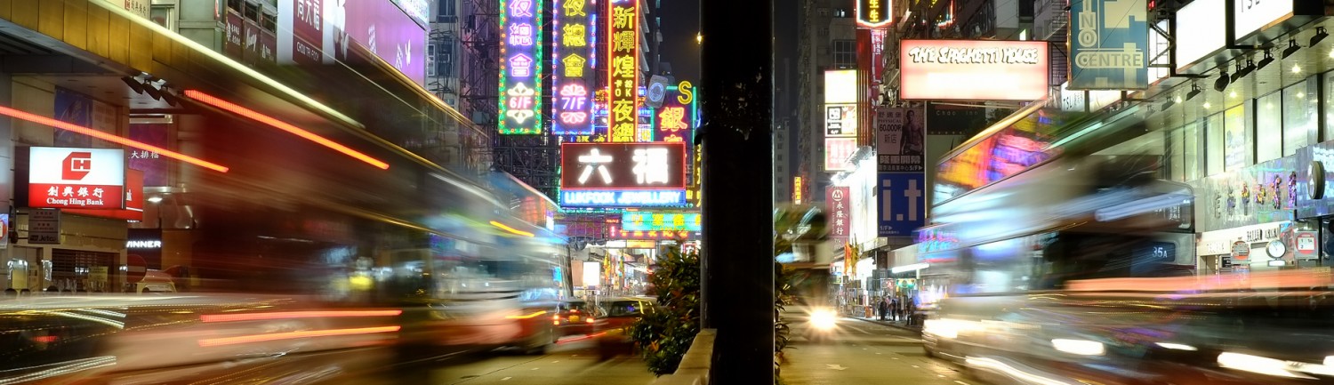
On the trails again.
There are several ways to approach the ridge, but the most popular starting at the BBQ site in Ma On Shan Country Park. This is a moderately challenging route that climbs several peaks, eventually reaching the Hunchbacks and then moving on to Ma On Shan peak. Along the way you’ll need to do some clambering with your hands, but the route is clearly marked and you’ll have plenty of company as it is a popular hike.
As you gain altitude, marvel at the views of Ma On Shan town and Tolo Harbour below.

The starting point at the BBQ site and the Family Walk trail.

Branch off the Family Walk on to the dirt trail and start climbing.

Splendid views of Ma On Shan town and Tolo Harbour.

More climbing and looking back at Ma On Shan Country Park.

Ma On Shan town, Shing Mun river, and Tolo Harbour.
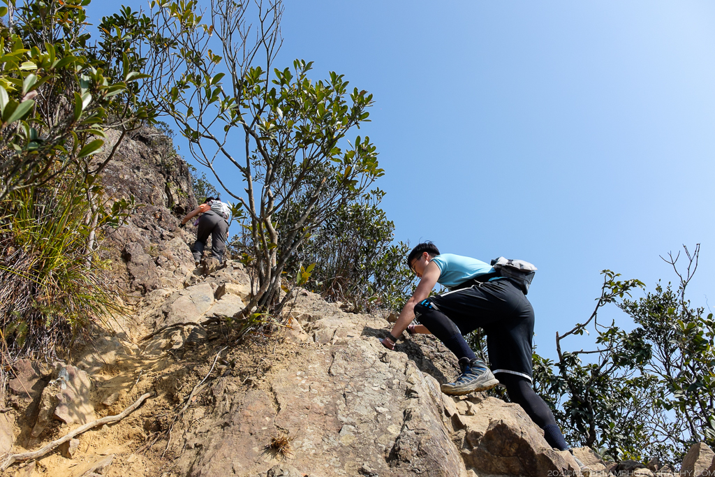
Some sections require clambering on all fours. Bring gloves if you have them.

The peak of Ma On Shan mountain.

Making our way through the bushes to The Hunchbacks, the first major peak.
After what feels like a never-ending climb, we finally reach The Hunchbacks, the twelfth-highest mountain in Hong Kong. This is a great place to take a break and have your lunch, and admire the views of Three Fathoms Cove below. From this vantage point, the ridge that connects to Ma On Shan peak is clearly visible. Get ready to cross the saddle!
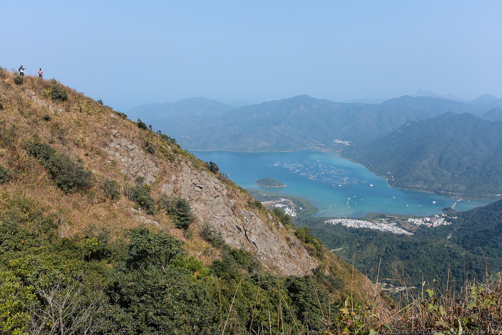
At The Hunchbacks, looking down at Sai Keng village and Three Fathoms Cove.
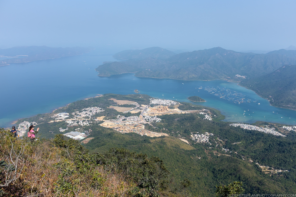
Lots of new housing developments at Tseng Tau Tsuen village.

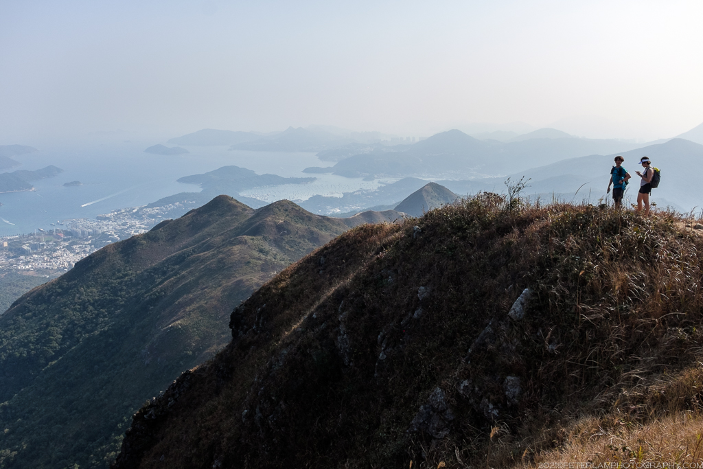
Looking towards Ma On Shan peak and the Saddle Ridge.
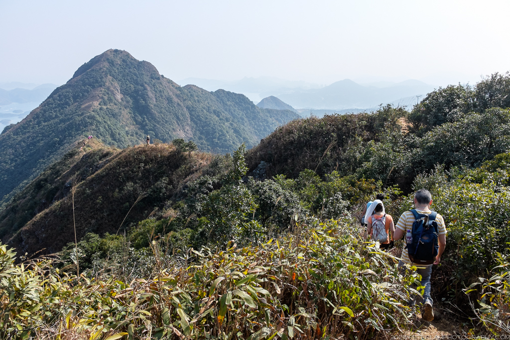
As we make our way to the ridge, heavy vegetation but the path is clearly visible.

Hiking the Saddle Ridge. Glorious!

Looking back at the Hunchbacks.

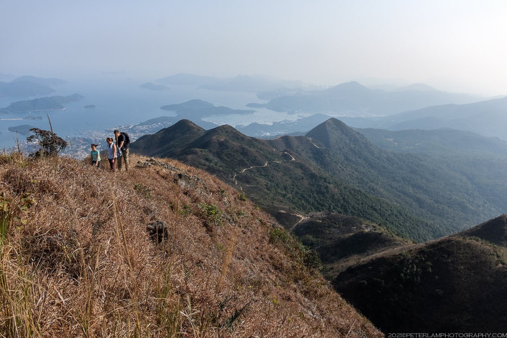
Reaching the second major peak, the summit at Ma On Shan.
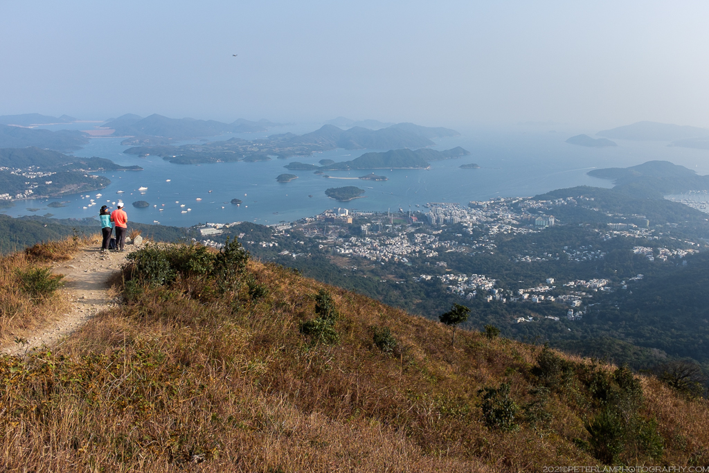
From Ma On Shan peak, the views to the east open up and in the distance our final destination is visible: Sai Kung town. The descent from the top follows a steep path that eventually connects to Stage 4 of the MacLehose Trail. Now comes the tricky downhill section – be aware of loose rocks and slippery gravel! It helps to have a hiking stick here, and proper footwear is essential.
Looking east towards Sai Kung.
Seems easy enough, just follow the trail!

One last look back at the Ma On Shan summit before descending.

A steep descent. Leave plenty of space and watch out for loose rocks.

Stop to admire the views (but do watch your step).

The trail leveling off and becoming easier.

Joining the MacLehose trail.
Once on the MacLehose Trail, simply follow it around Pyramid Hill 大金鐘 (or climb it, if you are feeling energetic) and arrive at Ngong Ping plateau with its popular campsite and great views of Sai Kung town. The rest of the route is downhill – shortly after the campsite, take the Ma On Shan Country Trail that leads directly to Sai Kung where you can have a well-deserved seafood dinner.

The winding MacLehose trail, Stage 4.
Taking a break with views of Sai Kung.

Lots of people on the trail today, and perfect hiking weather as well.

Approaching Pyramid Hill. Around, or over?

For the best views, get on the biggest rock you can find!

Through the forest around Pyramid Hill.

Feral cattle are a mainstay at Ngong Ping.

Camping is popular at Ngong Ping plateau.

The plateau viewpoint overlooking Sai Kung town.

Taking the Ma On Shan Country Trail down to Sai Kung.

The sun setting after a full day of hiking.
