
Day 3 of our trip was the beginning of a 4-day backpacking hike in Mount Robson Provincial Park. The Berg Lake Trail is a 22-km long trek through some of British Columbia’s most beautiful backcountry, terminating with Berg Lake at the foot of Mount Robson, the tallest mountain in the Canadian Rockies. Much of our trip was planned around this hike, as it is very popular (you need to book the campsites well in advance) and also physically demanding.
Click here for an outline of our Rocky Mountain adventure
After spending the previous night at a nearby lodge and packing only the essentials needed for the four days, we arrived at the Visitor Centre where we registered for the hike and had a quick breakfast. It was overcast and a bit gloomy, with clouds obscuring the peak of Mount Robson, but was expected to clear later in the day. The hike-in was divided into two days: a 11-km trek with a relatively easy elevation gain of 240m to Whitehorn campsite where we wound spend a night; and a second 11-km hike over a challenging 930m ascent up past Berg Lake to the Rearguard campsite. All this with 35 lbs of backpack strapped on my back…

The Visitor Centre with Mount Robson in the background.

The Berg Lake Trail campsites with distance and elevation markers.
The trailhead is located some distance from the visitor centre, so we drove in, parked the minivan, and geared up. We were ready to start on one of the best hikes in the Canadian Rockies.
Kinney Lake
The first section of the hike is a well-maintained path to Kinney Lake. This is a popular route for day hikes as well as mountain biking. The trail winds alongside the fast-moving Robson River, and about 7 km in you get the first glimpse of the lake and its turquoise water. The Kinney campground is located on the lake shore, complete with a wooden shelter for resting and cooking (no campfires are allowed in the park, so you have to bring your own stoves and fuel with your meals). There were fewer hikers on the trail beyond this point.
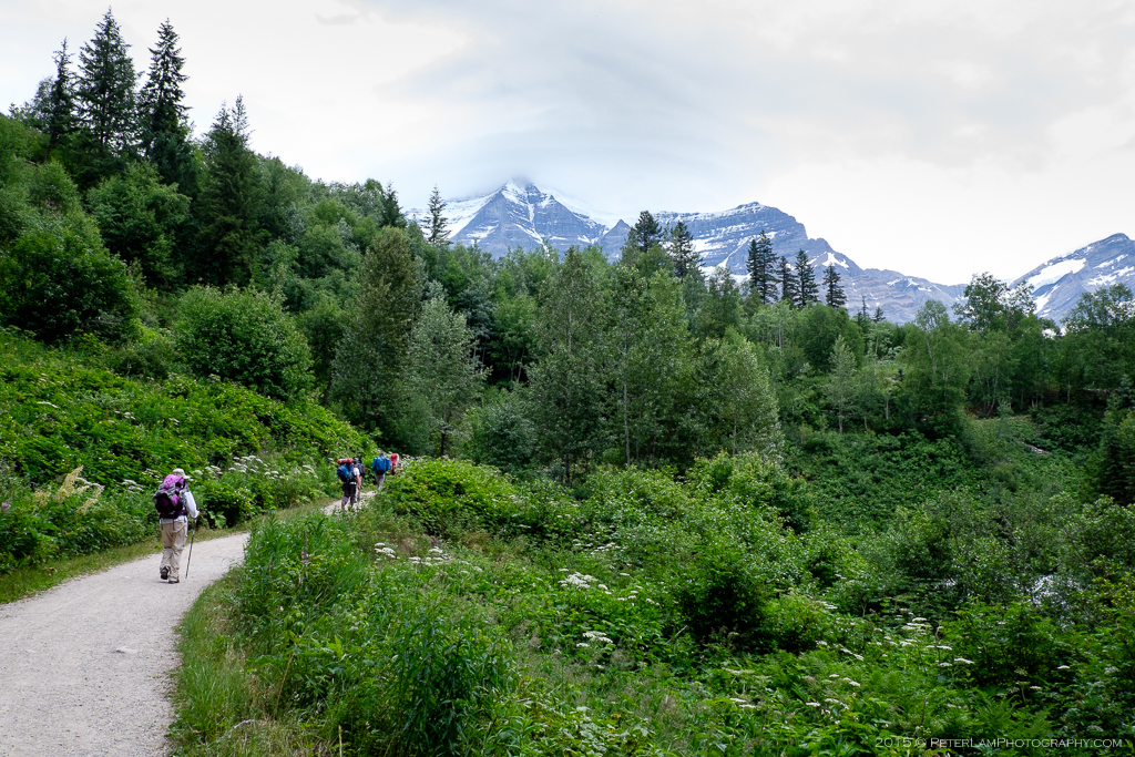
The beginning of the trail is relatively level.

Mount Robson looms overhead at every turn.
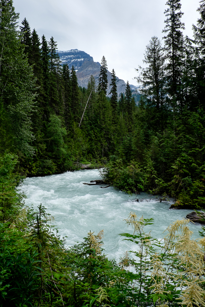
Fast moving Robson River, a tributary of the Fraser River.

Our first view of Kinney Lake.
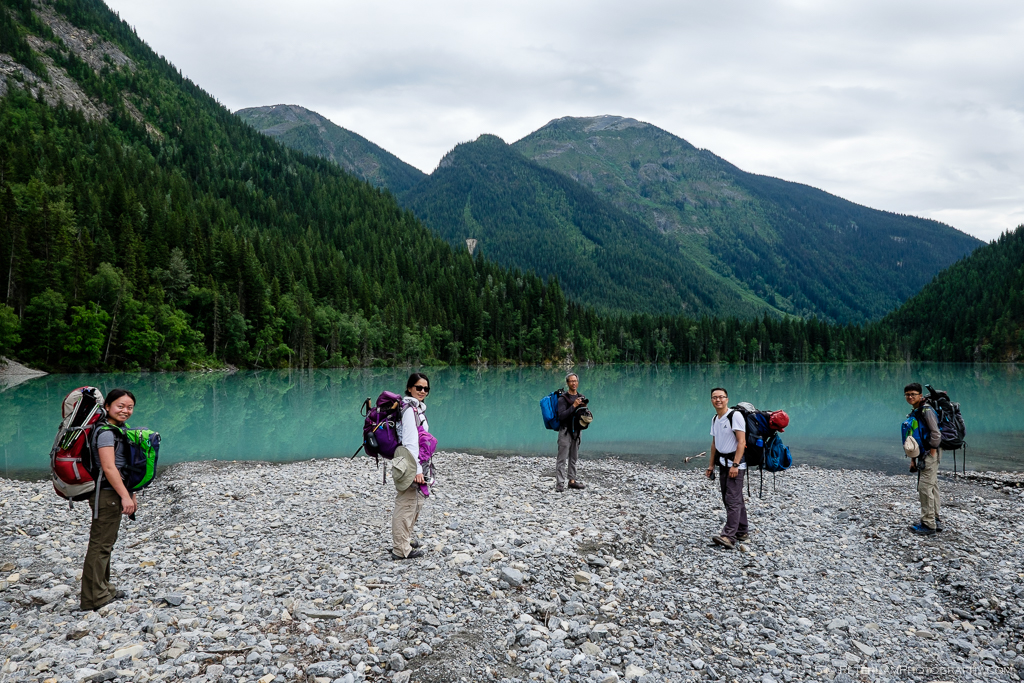
My trailmates: Emily, Yvonne, Jeff, Gabe, and Lewis.

Reflections off Kinney Lake.

The shelter at Kinney campsite.
To Whitehorn Camp
After a brief break for refueling, we continued on the trail. Just beyond Kinney Lake the path splits with the option to take a sidetrail through the moraine flats instead of the main trail through the woods. In the spring the flats are usually flooded with meltwater, but by summer this is a nice shortcut with great views of the valley (the visitor centre will let you know if the flats are passable). After crossing the flats you are back in the woods and start a small climb up – at the 11km mark you’ll cross a suspension bridge over the river, marking your arrival at Whitehorn camp.
We set up our tents and were quite happy to put our backpacks aside for the rest of the day. The campground is located next to the Robson River with a beautiful view of the valley and the peak of Whitehorn Mountain just beyond.
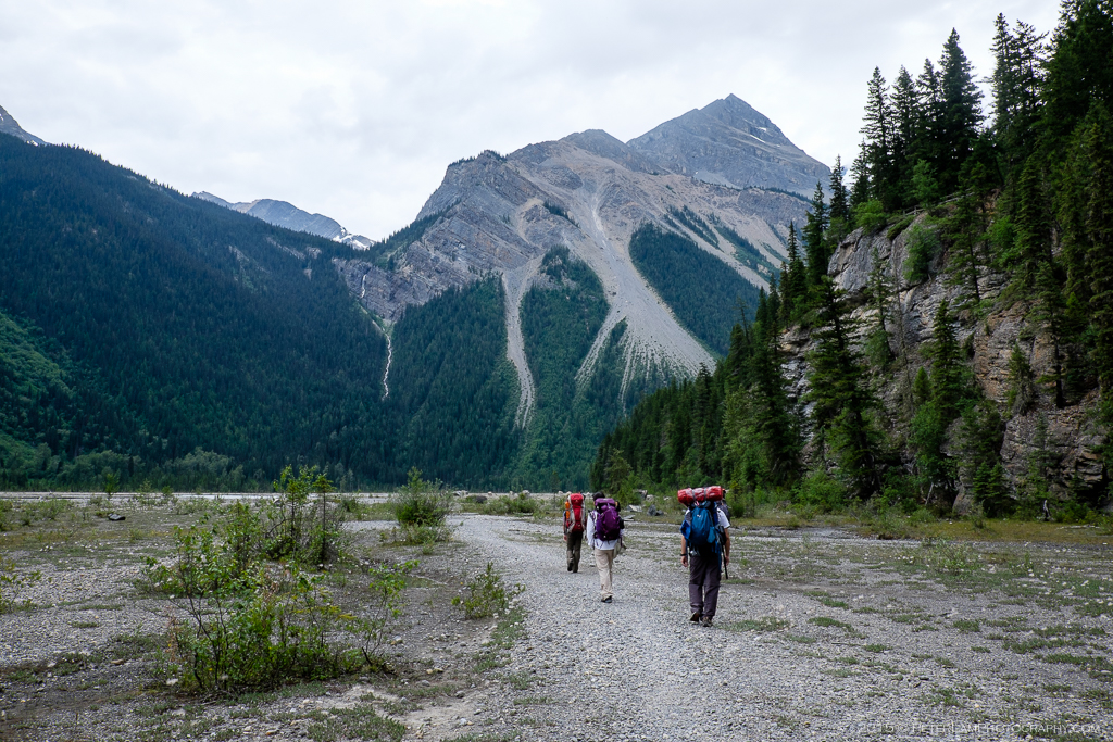
Taking the sidetrail over the flats.

Streams and lush forests blanket the valley.

One of the many crossings over the river.

No campfires allowed, but there is firewood available for emergency use.

Arriving at the campsite, with the ranger cabin in view. You can see aptly-named Whitehorn Mountain.

Suspension bridge over Robson River.

On the shores of Whitehorn campsite.

The Valley of a Thousand Falls.

Not a bad place to have camp dinner. What a view!
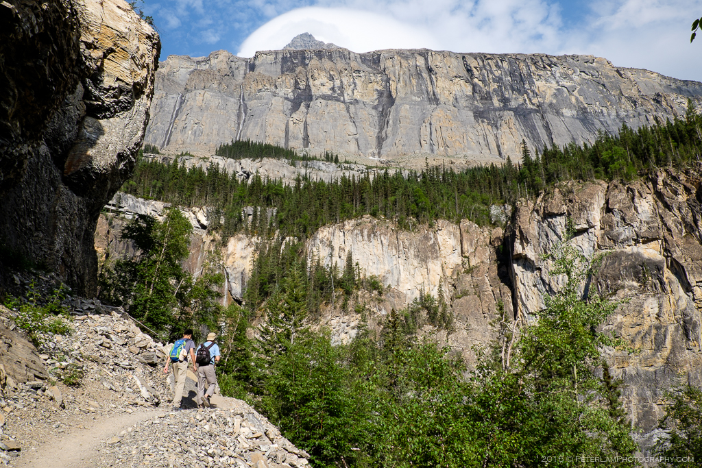
The Valley of a Thousand Falls
As promised by the weather forecast, the skies cleared a little and we took the opportunity to explore the camp and surrounding area. The next 5 km of the Berg Lake Trail winds through the Valley of a Thousand Falls, where numerous large and small waterfalls line the steep rock walls. This section is also the toughest part of the hike, as it is quite steep. We took advantage of the good weather to do a pre-hike up the slopes, free from our heavy backpacks; we were also expecting some rain the next day, so now was a great time to take pictures. The sheer massive rock faces and the roaring waterfalls were simply awe-inspiring.
After returning to the camp, we had dinner by the river and turned in early in anticipation of a challenging day ahead: the push onwards to Berg Lake.

Looking back at the flat plains with Kinney Lake in the distance.

The base of the White Falls, complete with rainbow.
The sheer scale of this rock face – pictures don’t do it justice. You can just see the tip of Mount Robson in the background.

Streams and waterfalls find their way down the steep slopes.

Beautiful light for photos as we head back down to Whitehorn campsite.
—————————————————————————–
