
This weekend trek was literally close to home in Tung Chung on Lautau Island. Adjacent to the new town development are a number of hills and trails rarely visited by Hong Kong hikers, who instead prefer the well-established sections of the Lantau Trail. As it turns out, some of these less popular routes offer some very challenging alternatives to the usual hikes. Add to this a stagnant air mass, a winter monsoon, and record-level pollution from the mainland, and you’ve got a memorable weekend in store.

Hazy views of Coastal Skyline and Caribbean Coast apartment complexes in Tung Chung.
The two peaks tackled on this hike are Por Kai Shan (婆髻山) and Pok To Yan (泊刀屻) mountains at 482m and 529m, respectively. These relatively benign-looking hills are visible from anywhere in Tung Chung, and are actually quite steep as we quickly found out. Starting out in from the town, we made our way along an access road to a water catchment structure where we start the ascent up the northern face of Por Kai Shan. After climbing a flight of concrete steps, the route became a dirt trail that was increasingly steep and rocky. The unusually warm weather combined with the poor air quality made this a challenging climb.
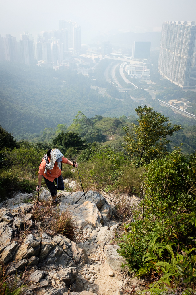
On the rocky path to Por Kai Shan with Tung Chung behind us.

About half way up the mountain, the peak of Por Kai Shan becomes visible (right).

Fellow hikers descending the mountain through the bushes.
The last section of the climb to Por Kai Shan was through some very dense growth that basically turned it into a steep bushwacking exercise, with portions requiring clambering on your hands and knees. Finally reaching the peak, we took a well-deserved break and enjoyed the hazy views of Tung Chung and the surrounding hillsides below. In contrast to the heavy brush on the northern slope, the opposite southern side is weathered and rocky with little vegetation. With a steep 60-degree gradient, this is not a section for the faint-hearted or anyone afraid of heights. The descent requires your full concentration, as one wrong step could easily result in disaster… On more than one occasion the “on-your-bum” technique was the only way to go!
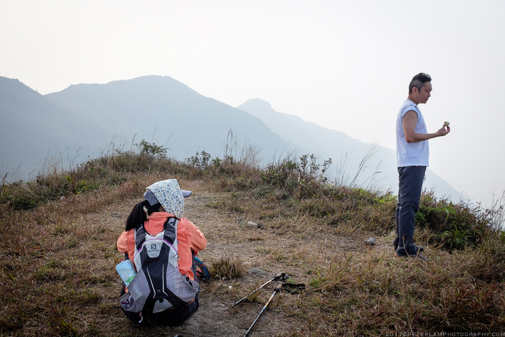
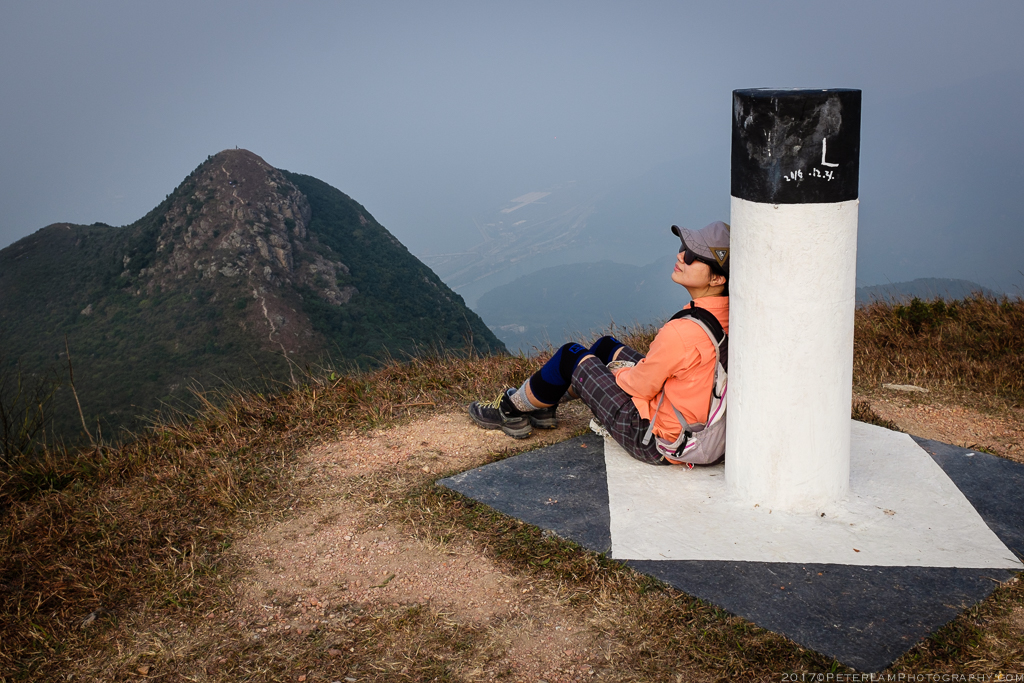
Taking a break at the summit of Por Kai Shan.

Heading down the northern face. Very steep and tricky.
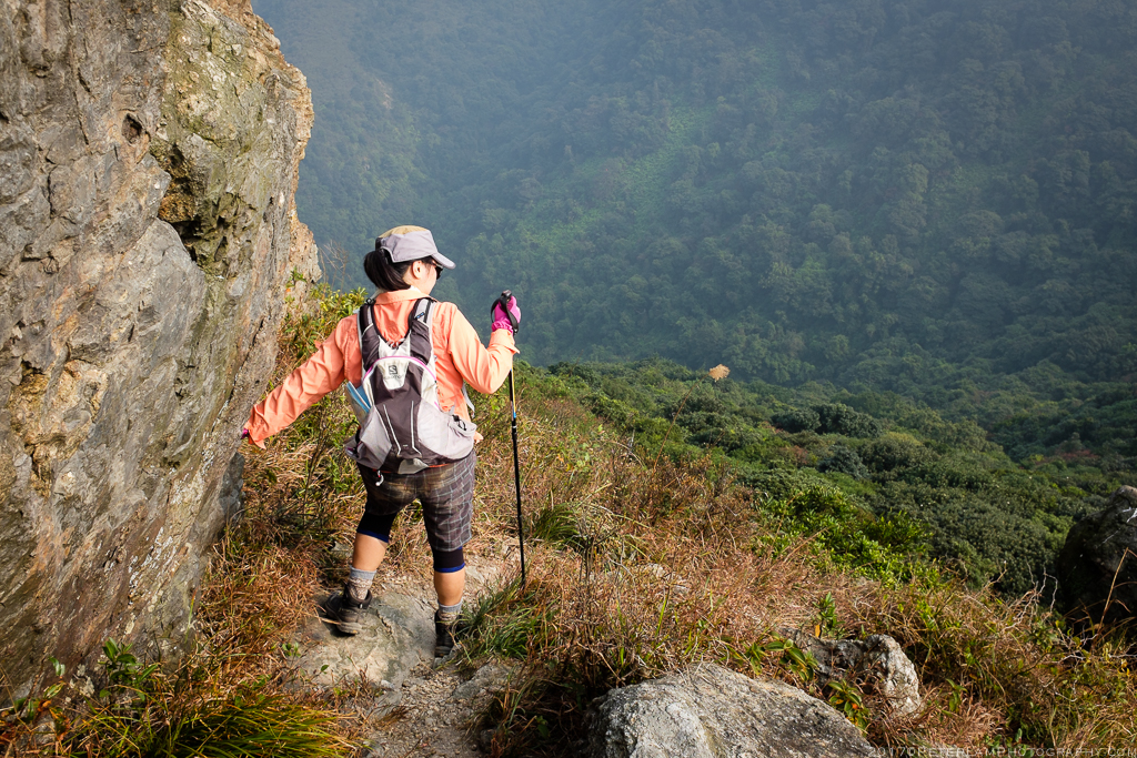
It’s a long way to go and requires your full concentration.

A look back at the southern face, and the steep incline at the top is apparent.
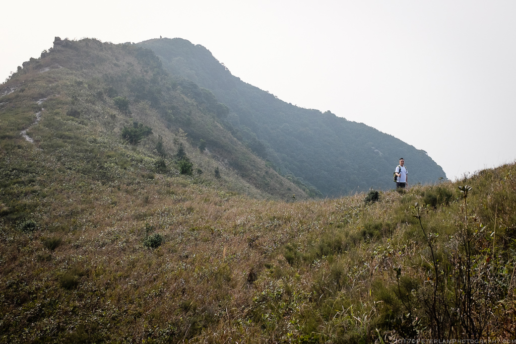
In contrast, the ascent to Pok To Yan was relatively easy with a gradual climb through some waist-level vegetation. The peak is the start of a ridge hike that extends westward towards our final destination at Wong Lung Hang. Most of the trail is well-defined and often marked with ribbons, but as you progress along the ridge the vegetation gets increasingly dense.

The valley adjacent to the Pok To Yan mountain ridge.
Edwin headed up Pok To Yan peak.
Yvonne taking a break after reaching Pok To Yan peak.
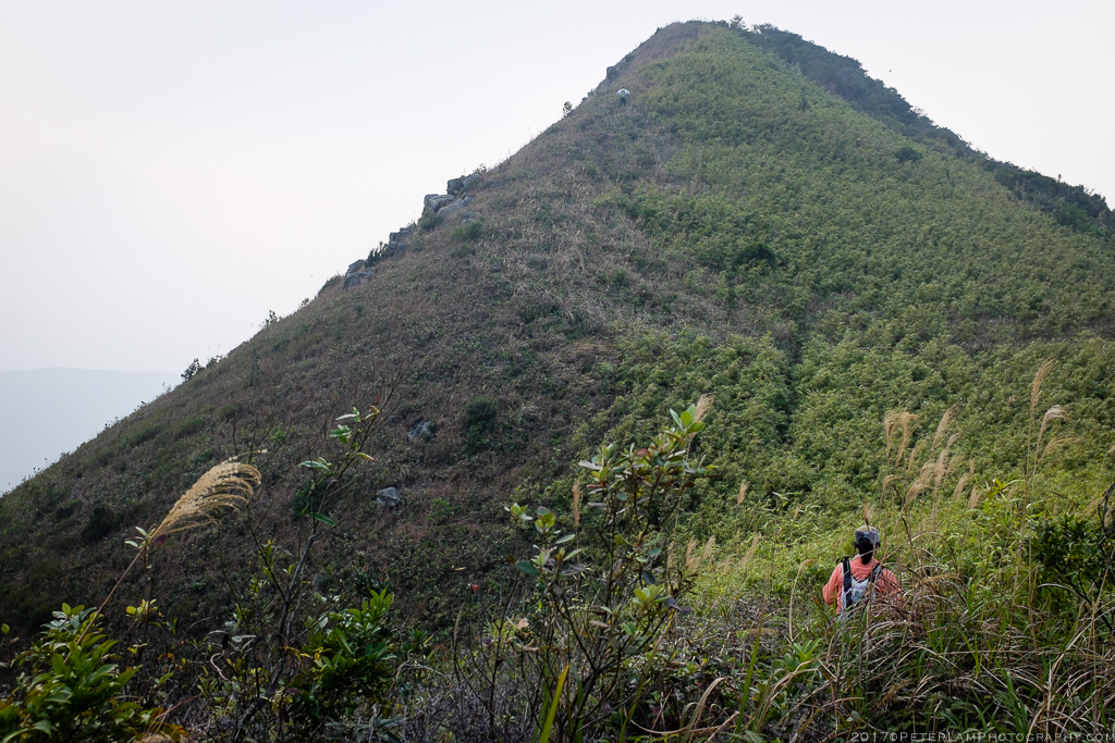
A look back at Por Kai Shan mountain. Hikers can bypass the peak by hiking the trail along the base.

Starting on the Pok To Yan ridge hike.

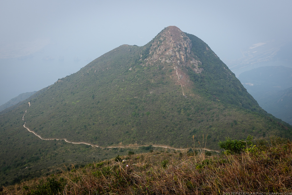
Passing one of many peaks, this one with an old trig column.
One more peak on the ridge before heading down.

More bushwacking as we go.
At about two-thirds along the ridge, we begin our descent down towards Wong Lung Hang on a ribboned sidetrail. Once again this is a very steep and tricky path, so great care must be taken clambering down. The trail follows an undulating mountain ridge that starts off bare but becomes increasingly dense with bushes and trees, so some bushwacking is required here too. We found ourselves hanging on the branches for support in some of the steeper inclines. By the time we reach the water catchment and basin at Wong Lung Hang, we’ve descended over 400m and it’s well past sunset. This is one trail you don’t want to do in the dark.

Beginning another steep section on a side trail.

The sun setting behind Lantau Peak as we are halfway down trail.

The water catchment plant visible ahead in the thick forest.
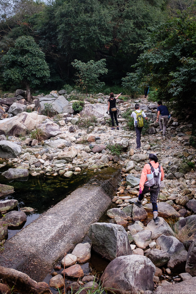
Finally reaching the bottom, and not a moment too soon.

Our final destination at Wong Lung Hang. From here it’s an easy 45-min walk back to Tung Chung town.
————————————————-
