Visible from virtually every corner of Sai Kung peninsula, Nam She Tsim (蚺蛇尖) is a mountain located in the northeastern corner of Sai Kung East Country Park. Also known as Sharp Peak, the aptly-named hill is not especially tall (at 469m it is only half the height of Lantau Peak) but is most famous for its well-defined pointy summit. The first time I saw that peak, about three years ago when I first started hiking in Hong Kong, I knew that one day I would be headed for the top. Anyone who’s ever been on the trails in Sai Kung will know that feeling – it’s an intimidating looking mountain. Sharp Peak is counted as one of Hong Kong’s three most treacherous summits, the other two being High Junk Peak (釣魚翁)and Castle Peak (青山).
Sharp Peak’s distinctive profile is visible from anywhere in Sai Kung.
There are several ways to the top, the most popular and safest being a network of official trails on the southern side of the mountain. A much more interesting option is an unofficial path up the northern face, which has a steep gradient and should only be attempted by experienced hikers in good weather conditions. Official maps do not mark this trail, but the route is well-established and documented for those who want to attempt it. Naturally, this is the one we’re interested in!
The northern ridge approach requires a bit of planning to get to the remote trailhead, but can easily be done as a day hike. With relatively cool and fine weather, and calm winds (very important), this past weekend was the perfect time to conquer Sharp Peak.
Approaching via Nam She Wan
Our journey begins in Sai Kung town where we take the bus to Wong Shek pier. Here we catch a ferry to Ko Lau Wan on the northern tip of the peninsula, and begin a southward hike toward Nam She Wan bay. Some portions of the trail are overgrown but in general the path follows a set of sewage and utility pipes to the small beach at the base of the mountain.
As you approach Nam She Wan, Sharp Peak looms larger and larger, and the steep northern face is intimidating indeed. There were a few campers on the beach but otherwise we had the trail to ourselves this day. On the sands we take a break, have a snack, and prepare ourselves mentally for the climb to come.

Arriving by ferry at Ko Lau Wan pier.

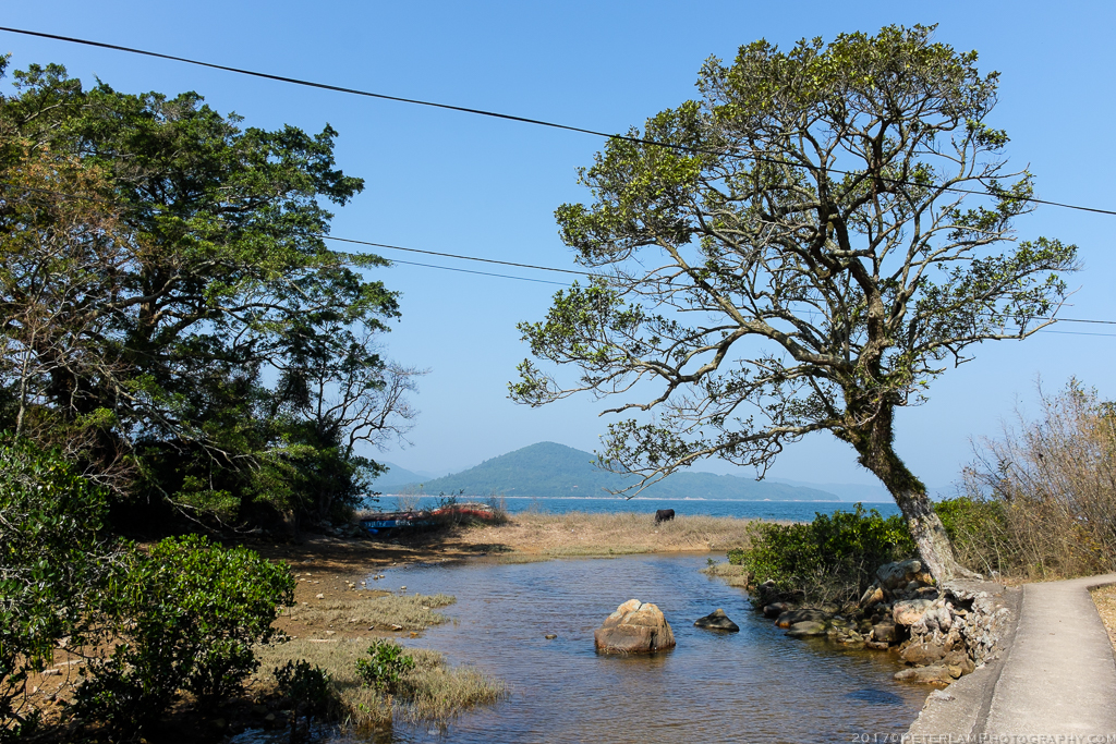
Secluded village on Tan Ka Wan, northern Sai Kung peninsula.
Looking back at the last concrete path we will see until the end of the hike.

A well defined dirt trail leading to the water pipes.

Some sections definitely overgrown.
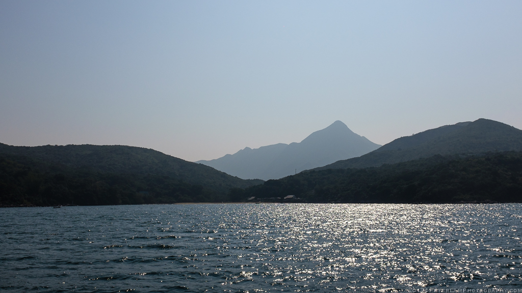
Approaching Nam She Wan bay and Sharp Peak.
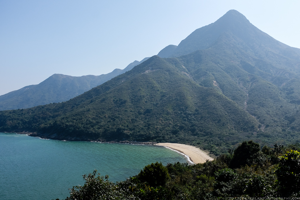
Nam She Wan beach at the base of the mountain.

Are we really going to climb this thing?

Arriving at Nam She Wan beach. You can just make out the ridge leading up to the peak.

Beautiful waters of Nam She Wan. You can also get here by private boat hire (kaito) but where’s the fun in that?
Up the Northern Ridge
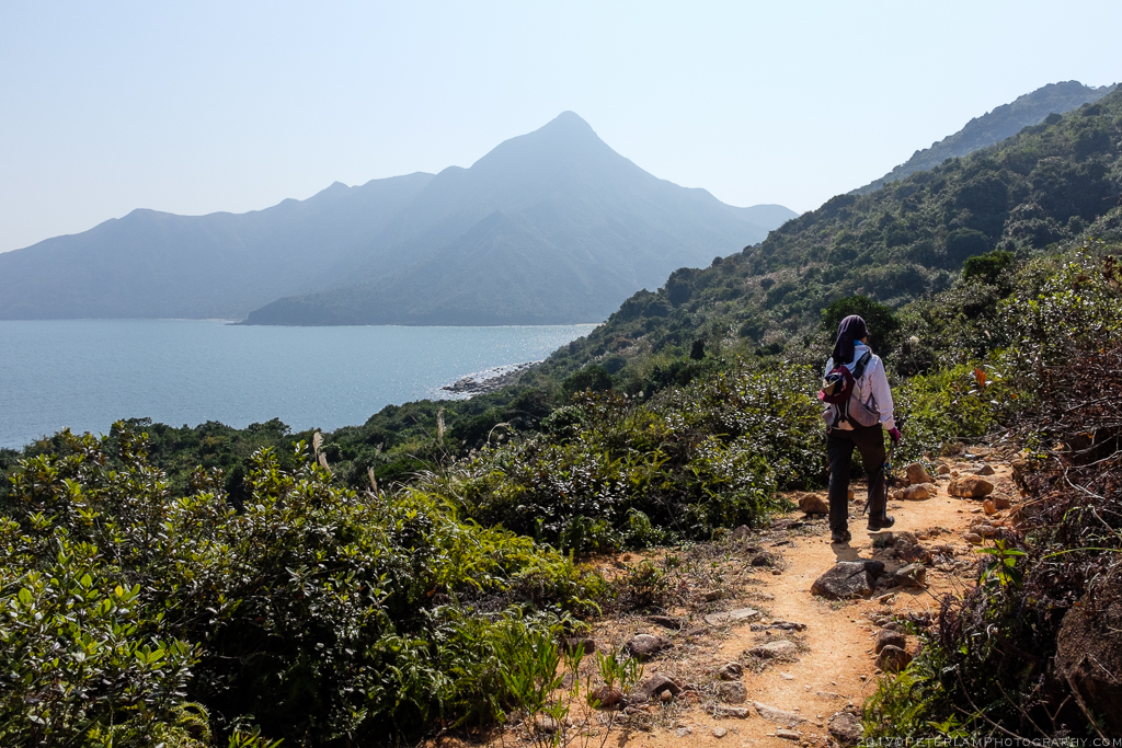
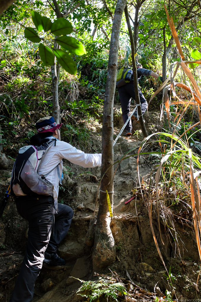
The real work begins at the trailhead located at the far end of the beach. An opening in the bushes marked with ribbons marks the entrance to the north ridge path (just look for the wild pineapple tree beside it). The route passes through some heavy woods which then thins out to typical mountain bush. All the while, you’re climbing a ridge over several mountain humps that give increasingly spectacular views of the ocean and surrounding hills. We took frequent breaks and admired the scenery. The path is clearly marked by ribbons so there is little chance of getting lost; in many sections, clambering up with your hands are required.
The last 100 meters to the top are the steepest; here the peak is rocky and overgrown with vegetation, so at times it feels you are actually tree-climbing your way up. But once you reach the summit – what a feeling of accomplishment! We were surprised to see quite a crowd (hikers taking the south side trails) and a party-like atmosphere.
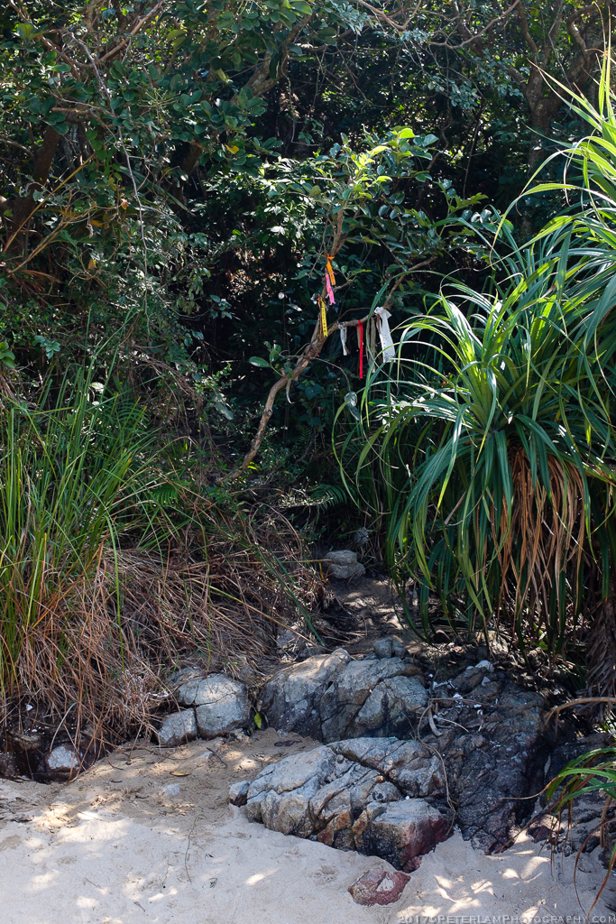
The trailhead for the north ridge.

Wild pineapples(?) next to the entrance.
The first portion is climbing through thick woods.
Taking a break over Nam She Wan beach.

About a third of the way up, and approaching the ridge.

Admiring the scenery at half way.

About two-thirds of the way and it gets steeper. You’re fully exposed to the elements here, so good weather conditions are essential.

One more break before the final push.
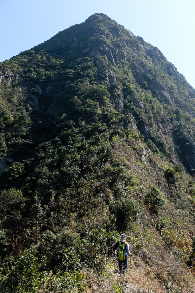
The last 100 meters look impossible, but there is a path!

15 meters to the top, and a metal ribbon is handy for the climb. Very steep here.
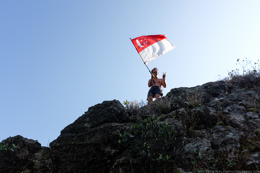
Our welcoming party, from Singapore!?

Party time at the peak.
Picture perfect weather.

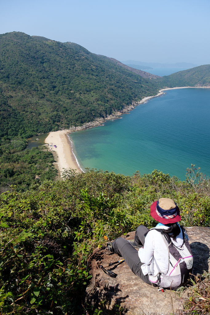
Looking east towards Tung Wan beach.

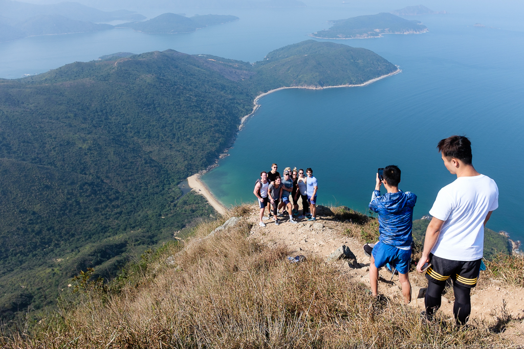
South towards Tai Long Wan bay and its three beaches.
To Tai Wan and Ham Tin
After a well-deserved break at the peak, we started our way down the mountain along the south eastern trails towards Tai Wan beach. Much of the route was on dirt trails with loose gravel but thankfully nowhere near as steep as the northern side. The views of Tai Long Wan bay and its famous beaches were breathtaking.
We took our time navigating the undulating hills and reached the pristine sands of Tai Wan beach just as the sun was beginning to set. Continuing along the length of the beach, we crossed over to adjacent Ham Tim where we relaxed at a beach store with an ice cold beverage and a bowl of instant ramen (after a hike like this, the noodles here are the best you’ve ever had). A time to marvel and reflect on what we had just accomplished; there was still some walking to do before the day was done, but the hard work was behind us. With today’s hike, we’ve finally completed the trinity of Hong Kong’s sharpest peaks.
We finish our adventure by hiking another 3km of the MacLehose Trail (Stage 2) from Ham Tin to Chek Keng, where we catch a kaito boat to Wong Shek pier and bus it back to Sai Kung town.
All in all, a day well spent.

Starting our descent towards Tai Long Wan bay.

The southern face of Sharp Peak is quite weathered with little vegetation.

The south-facing tip of Sharp Peak. Looks quite different from the north side.
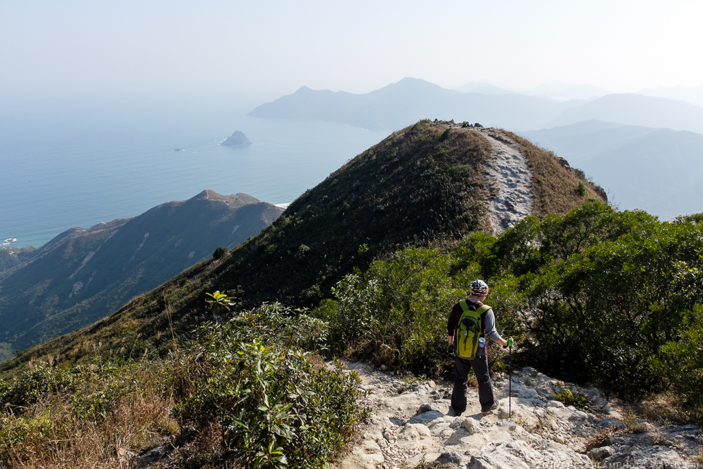
Making our way across multiple humps.

Fellow hikers on a ridge lookout.

What a great view, but pay attention to your footing.

Looking back and Sharp Peak is now a distant bump.

More areas of soil erosion.

Approaching beautiful Tai Wan beach.

One more hill to navigate and then head for the sands.

Pristine, unspoiled beach of Tai Wan. Possibly Hong Kong’s best.

Crossing the promontory at the end of the beach…

…down the hill…
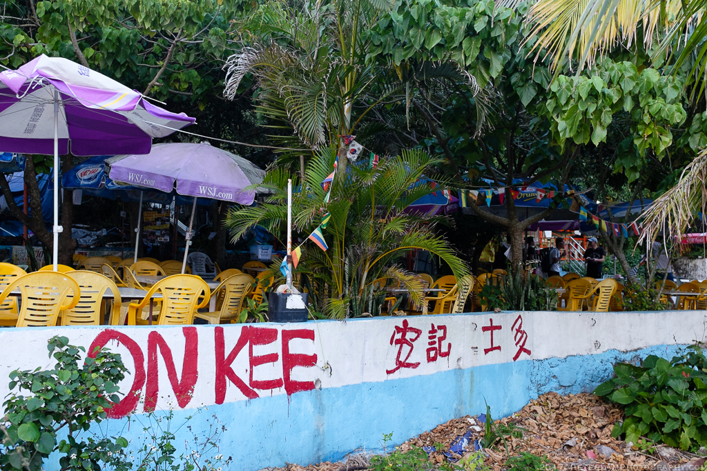
…and right to the beach store at Ham Tin! Time for noodles and ice cold drinks.

View of Ham Tin beach as the sun sets and we prepare for the final leg of our journey.
———————————————————————————-

What was the total time spent on the trail?
LikeLike
We spent about 6 hours in total, but that includes the leisurely approach to Sharp Peak and the break at Tai Wan beach. Well worth your time!
LikeLiked by 1 person
Hi,
Are there any accommodations on the beaches? Really want to spend overnight there..
LikeLike
You can bring your own tent and camp on the beach – or if at Ham Tin beach, it could be possible to rent the gear from the stores located there. Best to call them and check for options.
LikeLike
Great post, really want to try this hike! Would you say it’s too difficult for a beginner hiker though?
LikeLike
It might be too much for a beginner… There are lots of trails in Sai Kung (or Hong Kong in general) that are equally rewarding but easier. Try for example MacLehose stages 1 and 2, for example.
LikeLike
Thanks for the advice, guess it’s one to save for later then!
LikeLiked by 1 person