Our grand trip to Alberta centered on the trek through Mount Assiniboine Provincial Park, but we did manage to do a few other day hikes in the Canadian Rockies. One was the Tent Ridge Horseshoe trail in Kananaskis Country near our home base in Canmore. This was our “warm-up” hike in advance of heading into the backcountry, and it turned out to be a spectacular and challenging pick.

Breathtaking views from the Tent Ridge peak.
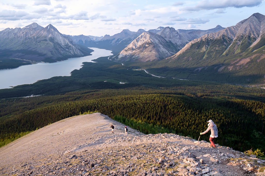
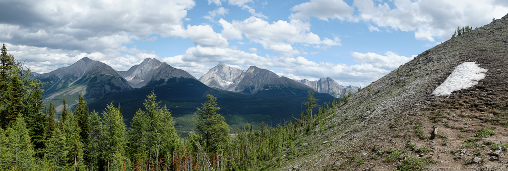
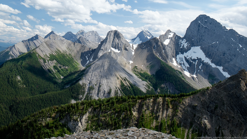
Nestled among tall peaks, the horseshoe-shaped ridge promises unbeatable views of the surrounding maintains and the Spray Lakes Reservoir. It is a popular and well marked loop hike, spanning 11 km with a total climb of about 800 meters. The ridge portion is entirely exposed to the elements, so it is important to be prepared for changing weather conditions.
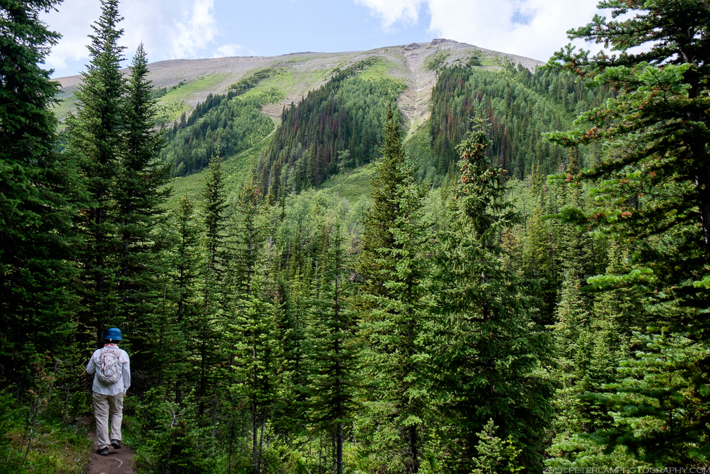
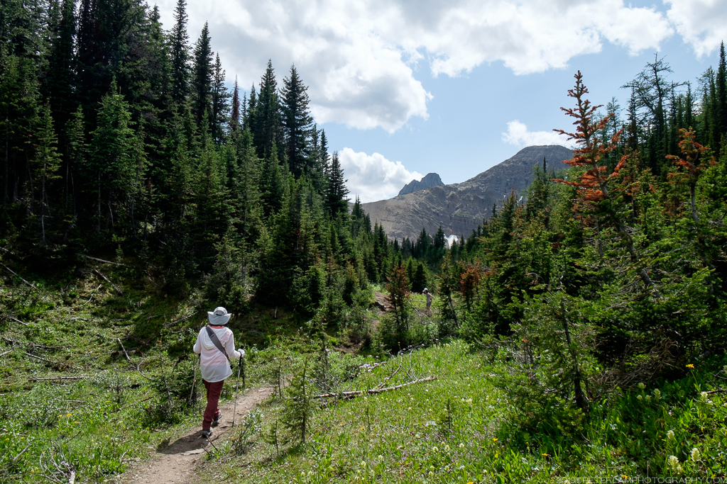
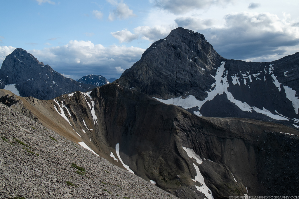
From the parking lot, the hike starts easy with a gradual ascent through wooded areas that don’t offer much in terms of views. Eventually the trees open up and we soon cross a small stream, Monica Brook, and onto Monica Meadows, surrounded by wildflowers and a panoramic vista of the ridge from the valley floor. From the basin with the ridge looming overhead on three sides, the challenge ahead becomes clear – we would climb the steep slope and traverse the ridge in a clockwise direction. Other hikers already on the ridge were barely visible as tiny little dots on the horizon.


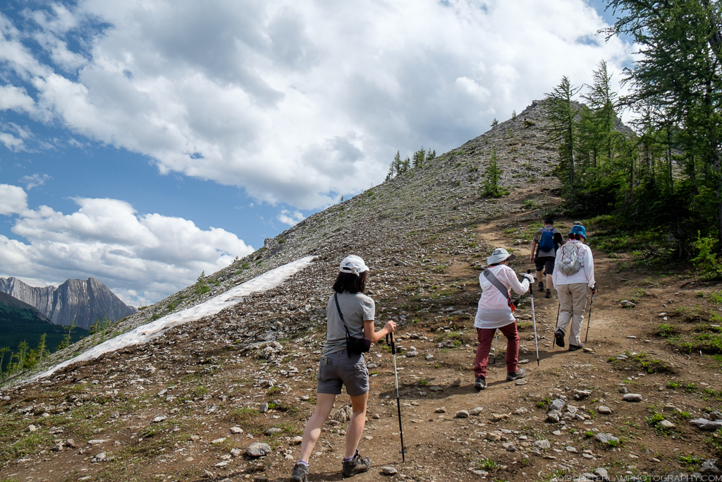
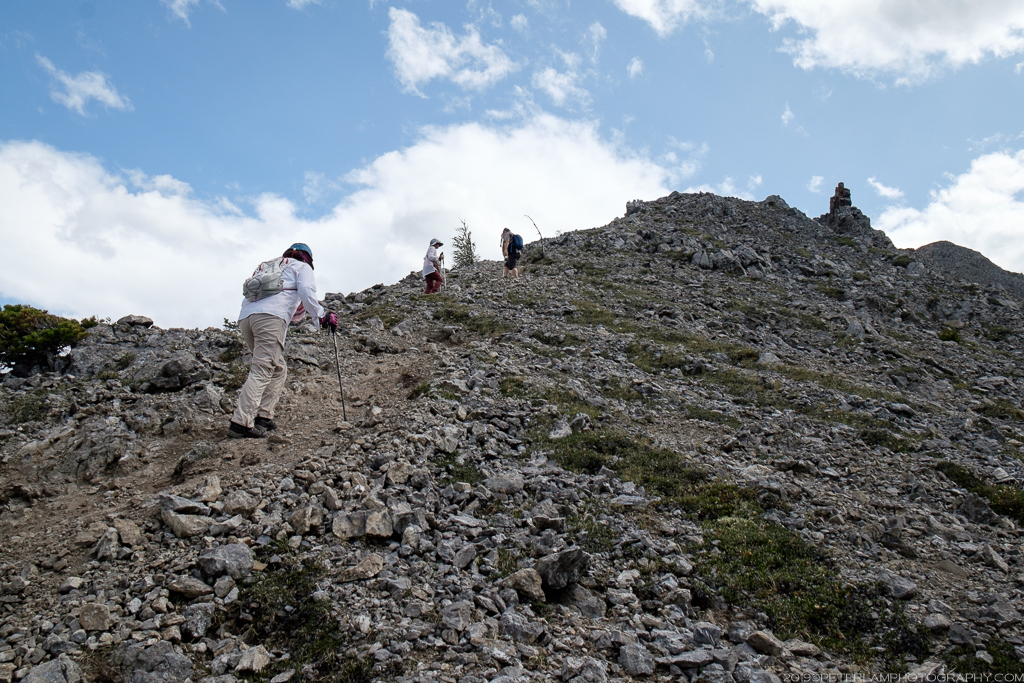
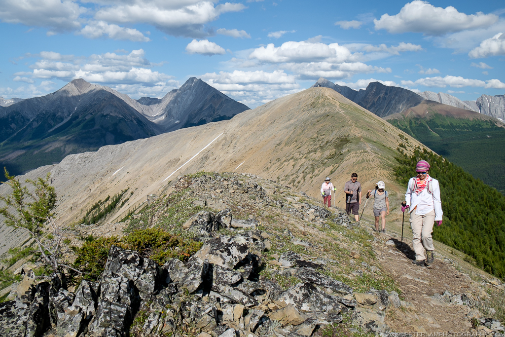
 Leaving the trees behind us, we scramble up the scree slope and start along the ridge, scaling several false summits before reaching a weather station (a welcome shelter from the wind) at the end of the first section. The views along the way are fantastic, especially of the Spray Lakes Reservoir behind us, and the undulating peaks to the east.


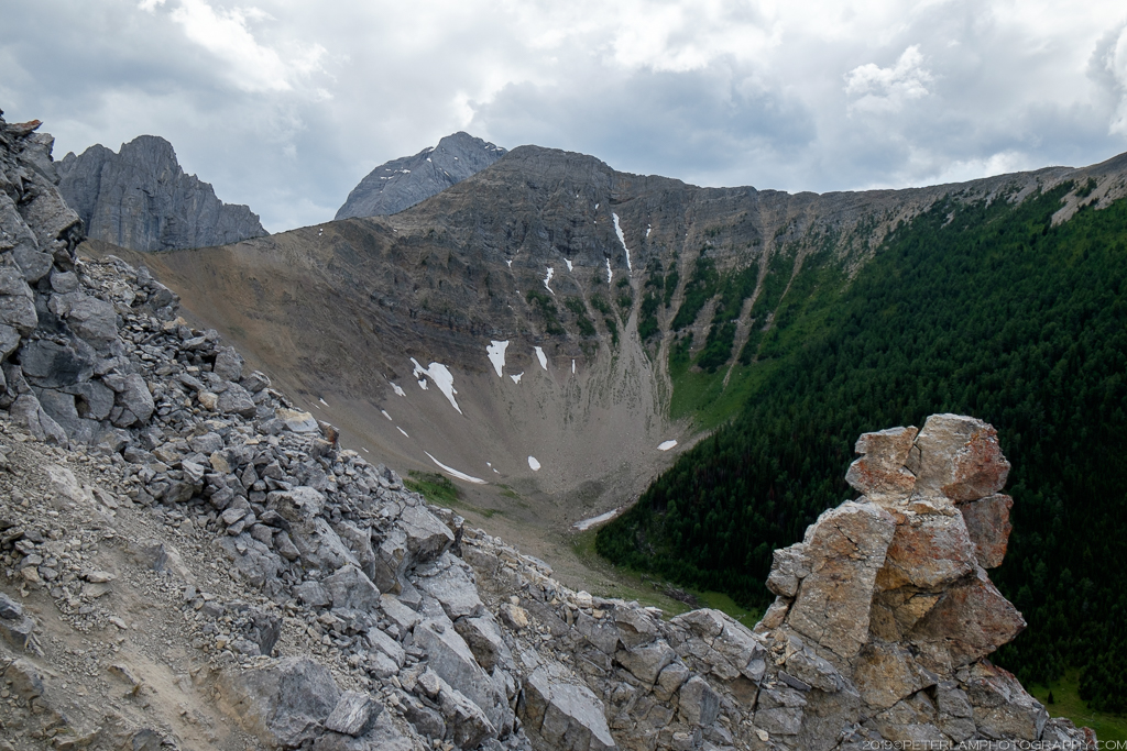


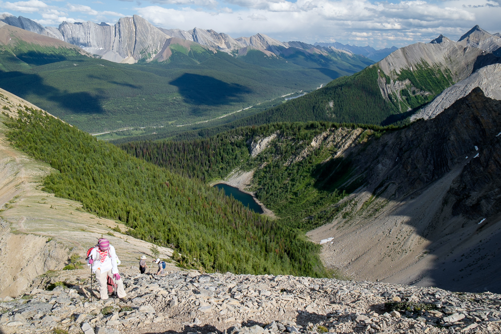
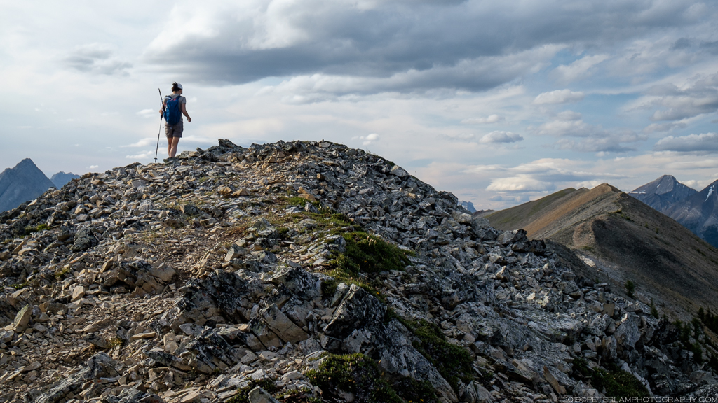
 The trail descends to the midpoint of the horseshoe with amazing views of the valley floor before rising again to the ridge peak, the summit of the hike. Navigating this section requires some climbing on all fours but is well worth the effort. From the top, simply amazing views of The Fist and Mount Shark peaks and a good place to take a break before traversing the last portion of the ridge.


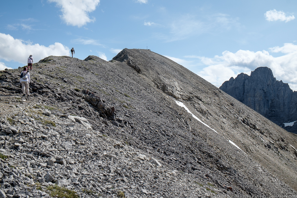
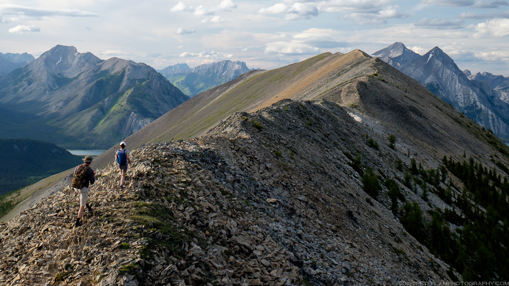
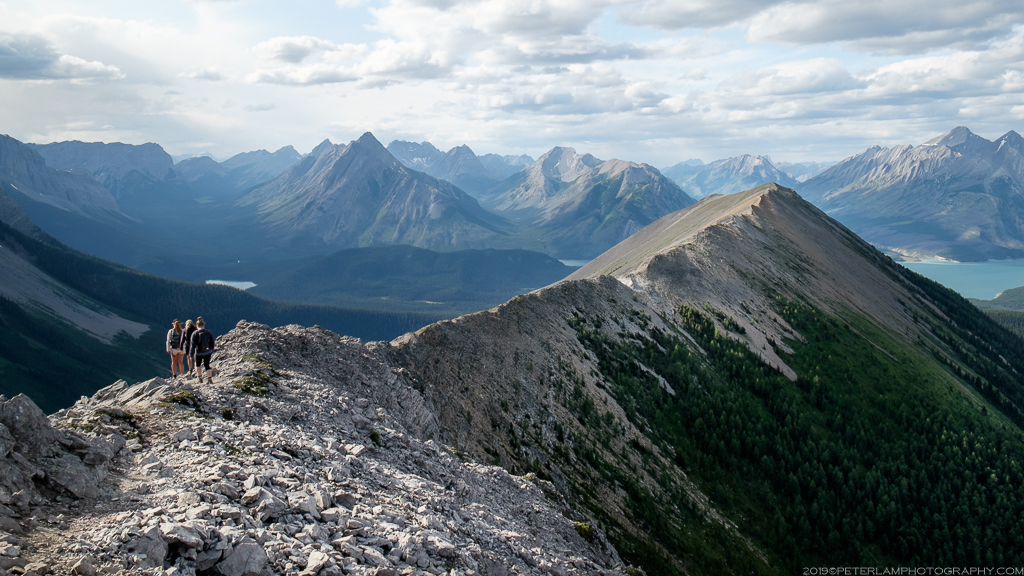 The western portion is arguably the most scenic, with gentle rise and fall of the trail tracing the narrow ridge. To our left, a wide valley that leads to the Assiniboine region where we would be spending the next few days in the backcountry – we can even make out Mount Assiniboine peak in the distance.

 As the sun starts to set, we begin our descent from the ridge amid more spectacular views of the Spray Lakes Reservoir before the trail leads back to the valley floor and the forest. The path eventually merges with a logging road that leads back to the parking lot area, and the end of the loop.